
Nature by public transport

Find the station, bus stop and final walk for your destination. Use the Korean entrance name on local maps, then check the service home for your travel date.

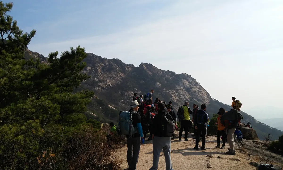
Hikers resting among the pine trees and granite ridges of Bukhansan National Park
Bukhansan National ParkPhoto by Christian Bolz

Find nearby stations and stops

Look up Seoul bus stops and rail stations across the capital area. Choose a trail landmark to explore before your trip, or search from your current location.

Find connections in other regions

Where are you headed?

95 destinations have sourced directions. Choose the region where you will enter the park, join the trail or reach the water.

Search places with public transport directions

Timetables & tickets

Mountain

Achasan

Start at
Achasan Station (Line 5)
Arrive at
아차산생태공원
Public transportRoute guide

Access region: Seoul

Getting there from Achasan Station (Line 5)

  1. Take exit 2 at Achasan Station (아차산역).
  2. Walk about 1 km to the Achasan Ecological Park area at 135 Yeonghwasa-ro, Gwangjin-gu. The mountain trail starts in the park’s pine grove.

Checked Visit Seoul · Achasan Mountain

Check the final walk and the last return service for your travel date.

Plan return trip

Directions open in Google Maps. Check local connections in the VISITKOREA route planner. Services depend on your travel date and time.
River

Anyangcheon

Start at
Guil Station (Line 1)
Arrive at
구일역 1번 출구
Public transportRoute guide

Access region: Seoul

Getting there from Guil Station (Line 1)

  1. Use exit 1 at Guil Station (구일역).
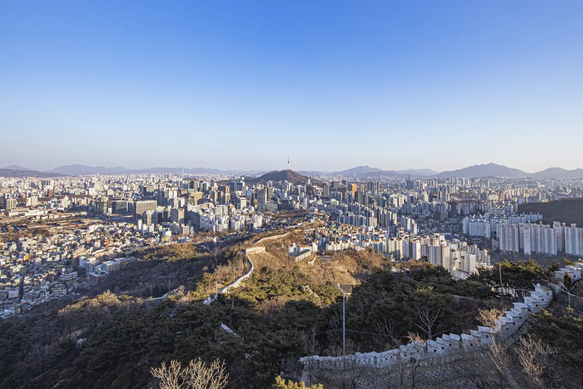
  2. Start Seoul Trail Course 14 here and follow the lower Anyangcheon Stream. This is a Seoul access point on a river that also runs through Gyeonggi.

Checked Seoul Trail · Course 14, Lower Anyangcheon (Korean)

Check the final walk and the last return service for your travel date.

Plan return trip

Directions open in Google Maps. Check local connections in the VISITKOREA route planner. Services depend on your travel date and time.
Recreation area

Banpo Hangang Park

Start at
Sinbanpo Station (Line 9)
Arrive at
반포한강공원
Public transportRoute guide

Access region: Seoul

Getting there from Sinbanpo Station (Line 9)

  1. Leave Sinbanpo Station (신반포역) by exit 1.
  2. Walk to the Banpo underpass (반포나들목) and pass through it into the park. Allow about 15 minutes from the station.

Checked Seoul Hangang Parks · official access directions (Korean)

Check the final walk and the last return service for your travel date.

Plan return trip

Directions open in Google Maps. Check local connections in the VISITKOREA route planner. Services depend on your travel date and time.

Mountain

Bugaksan

Start at
Gyeongbokgung Station (Line 3)
Arrive at
창의문
Plan a trip to this entrance
Public transportRoute guide

Access region: Seoul

Getting there from Gyeongbokgung Station (Line 3)

  1. From exit 3 at Gyeongbokgung Station (경복궁역), take green bus 7212, 1020 or 7022.
  2. Alight at Jahamun Pass / Yun Dong-ju Hill (자하문고개·윤동주시인의언덕). Walk about 2 minutes to Changuimun Gate, where the Bugaksan city-wall hike starts.

Checked Seoul City Wall · Baegak section, Changuimun directions (Korean)

Check the final walk and the last return service for your travel date.

Plan return trip

Directions open in Google Maps. Check local connections in the VISITKOREA route planner. Services depend on your travel date and time.

National park

Bukhansan National Park

Start at
Gupabal Station, Seoul Subway Line 3
Arrive at
삼천탐방지원센터
Public transportRoute guide

Access region: Seoul

Getting there from Gupabal Station, Seoul Subway Line 3

  1. Use exit 3 and take bus 7723 at the stop behind the exit. Get off at Hana High School, Samcheonsa and Jingwansa (하나고·삼천사·진관사입구).
  2. Turn right toward Samcheonsa. Walk up the road for about nine minutes to Samcheon Visitor Center (삼천탐방지원센터).

Checked Seoul City hiking access guide

Check the final walk and the last return service for your travel date.

Plan return trip

Directions open in Google Maps. Check local connections in the VISITKOREA route planner. Services depend on your travel date and time.

Recreation area

Gangseo Hangang Park

Start at
Banghwa Station (Line 5)
Arrive at
강서한강공원
Plan a trip to this entrance
Public transportRoute guide

Access region: Seoul

Getting there from Banghwa Station (Line 5)

  1. At exit 2 of Banghwa Station (방화역), take local bus Gangseo 07 (강서07) to its terminus by Gangseo Wetland Eco Park (강서습지생태공원).
  2. Walk about 50 m to the Jeonggok underpass (정곡나들목). Pass under the Olympic Expressway to reach Gangseo Hangang Park.

Checked Seoul Hangang Parks · official access directions (Korean)

Check the final walk and the last return service for your travel date.

Plan return trip

Directions open in Google Maps. Check local connections in the VISITKOREA route planner. Services depend on your travel date and time.

Mountain

Gwanaksan

Start at
Gwanaksan Station (Sillim Line)
Arrive at
관악산공원 입구
Plan a trip to this entrance
Public transportRoute guide

Access region: Seoul

Getting there from Gwanaksan Station (Sillim Line)

  1. At Gwanaksan Station (관악산역), follow signs to exit 1. The Seoul Hiking Tourism Center is inside the station by this exit.
  2. Continue on foot to the Gwanaksan Mountain Park entrance on the Seoul side of the mountain.

Checked Visit Seoul · Gwanaksan Hiking Tourism Center and park entrance

Check the final walk and the last return service for your travel date.

Plan return trip

Directions open in Google Maps. Check local connections in the VISITKOREA route planner. Services depend on your travel date and time.

Recreation area

Gwangnaru Hangang Park

Start at
Cheonho Station (Lines 5 and 8)
Arrive at
광나루한강공원
Public transportRoute guide

Access region: Seoul

Getting there from Cheonho Station (Lines 5 and 8)

  1. Use exit 2 or 10 at Cheonho Station (천호역).
  2. Walk toward Cheonho Bridge (천호대교) and use its stairs to reach the riverside park. The city lists about 500 m.

Checked Seoul Hangang Parks · official access directions (Korean)

Check the final walk and the last return service for your travel date.

Plan return trip

Directions open in Google Maps. Check local connections in the VISITKOREA route planner. Services depend on your travel date and time.

River

Han River

Start at
Yeouinaru Station (Line 5)
Arrive at
여의도한강공원
Public transportRoute guide

Access region: Seoul

Getting there from Yeouinaru Station (Line 5)

  1. For a public riverside access point in Seoul, take exit 2 or 3 at Yeouinaru Station (여의나루역).
  2. Walk about a minute to the heart of Yeouido Hangang Park. This route reaches the Seoul section of the Han River.

Checked Seoul Hangang Parks · Yeouido access directions (Korean)

Check the final walk and the last return service for your travel date.

Plan return trip

Directions open in Google Maps. Check local connections in the VISITKOREA route planner. Services depend on your travel date and time.

River

Hongjecheon

Start at
Hongje Station (Line 3)
Arrive at
홍제폭포
Public transportRoute guide

Access region: Seoul

Getting there from Hongje Station (Line 3)

  1. At exit 4 of Hongje Station (홍제역), take bus 7713 or 7738.
  2. Alight at Baekryeon Bridge (백련교). Walk about 210 m to the waterfall beside Hongjecheon Stream.

Checked Visit Seoul · Hongjecheon Artificial Waterfall

Check the final walk and the last return service for your travel date.

Plan return trip

Directions open in Google Maps. Check local connections in the VISITKOREA route planner. Services depend on your travel date and time.

Recreation area

Ichon Hangang Park

Start at
Ichon Station (Line 4 or Gyeongui–Jungang Line)
Arrive at
이촌한강공원
Public transportRoute guide

Access region: Seoul

Getting there from Ichon Station (Line 4 or Gyeongui–Jungang Line)

  1. Use exit 4 at Ichon Station (이촌역).
  2. Walk about 500 m from the exit to Ichon Hangang Park.

Checked Seoul Hangang Parks · official access directions (Korean)

Check the final walk and the last return service for your travel date.

Plan return trip

Directions open in Google Maps. Check local connections in the VISITKOREA route planner. Services depend on your travel date and time.

Mountain

Inwangsan

Start at
Gyeongbokgung Station (Line 3)
Arrive at
사직단
Public transportRoute guide

Access region: Seoul

Getting there from Gyeongbokgung Station (Line 3)

  1. Leave Gyeongbokgung Station (경복궁역) by exit 1.
  2. Walk about 400 m toward Sajik Park to reach Sajikdan Altar (사직단), a starting point for the Inwangsan foothill walk.

Checked Seoul Trail · Inwangsan Forest Trail access (Korean)

Check the final walk and the last return service for your travel date.

Plan return trip

Directions open in Google Maps. Check local connections in the VISITKOREA route planner. Services depend on your travel date and time.

Recreation area

Jamsil Hangang Park

Start at
Jamsillaru Station (Line 2)
Arrive at
잠실한강공원
Public transportRoute guide

Access region: Seoul

Getting there from Jamsillaru Station (Line 2)

  1. Leave Jamsillaru Station (잠실나루역) through exit 3 or 4.
  2. Take the pedestrian overpass into Jamsil Hangang Park. Allow about 8 minutes on foot.

Checked Seoul Hangang Parks · official access directions (Korean)

Check the final walk and the last return service for your travel date.

Plan return trip

Directions open in Google Maps. Check local connections in the VISITKOREA route planner. Services depend on your travel date and time.

Recreation area

Jamwon Hangang Park

Start at
Jamwon Station (Line 3)
Arrive at
잠원한강공원
Public transportRoute guide

Access region: Seoul

Getting there from Jamwon Station (Line 3)

  1. Take exit 4 at Jamwon Station (잠원역) and walk toward the Jamwon Hanshin Apartments.
  2. Use the Jamwon underpass (잠원나들목) to reach the riverside. Allow about 15 minutes from the station.

Checked Seoul Hangang Parks · official access directions (Korean)

Check the final walk and the last return service for your travel date.

Plan return trip

Directions open in Google Maps. Check local connections in the VISITKOREA route planner. Services depend on your travel date and time.

River

Jungnangcheon

Start at
Taereung Station (Lines 6 and 7)
Arrive at
중랑장미공원
Public transportRoute guide

Access region: Seoul

Getting there from Taereung Station (Lines 6 and 7)

  1. Take exit 8 at Taereung Station (태릉입구역).
  2. Walk about 110 m to Jungnang Rose Park (중랑장미공원), a public access point on the Seoul section of Jungnangcheon Stream.

Checked Visit Seoul · Jungnang Rose Park venue and directionsVisit Seoul · Jungnangcheon riverside location

Check the final walk and the last return service for your travel date.

Plan return trip

Directions open in Google Maps. Check local connections in the VISITKOREA route planner. Services depend on your travel date and time.

Recreation area

Mangwon Hangang Park

Start at
Mangwon Station (Line 6)
Arrive at
망원한강공원
Public transportRoute guide

Access region: Seoul

Getting there from Mangwon Station (Line 6)

  1. At Mangwon Station (망원역), leave by exit 1 to transfer to a local bus.
  2. Board Mapo 09 (마포09) or Mapo 16 (마포16) and get off at Mangwon Hangang Park (망원한강공원).

Checked Seoul Hangang Parks · official access directions (Korean)

Check the final walk and the last return service for your travel date.

Plan return trip

Directions open in Google Maps. Check local connections in the VISITKOREA route planner. Services depend on your travel date and time.

Recreation area

Nanji Hangang Park

Start at
Mapo-gu Office Station (Line 6)
Arrive at
난지한강공원
Public transportRoute guide

Access region: Seoul

Getting there from Mapo-gu Office Station (Line 6)

  1. Take exit 7 at Mapo-gu Office Station (마포구청역).
  2. Follow Hongjecheon Stream (홍제천) toward the Han River to enter Nanji Hangang Park. The walk is about 1.3 km or 20 minutes.

Checked Seoul Hangang Parks · official access directions (Korean)

Check the final walk and the last return service for your travel date.

Plan return trip

Directions open in Google Maps. Check local connections in the VISITKOREA route planner. Services depend on your travel date and time.

Recreation area

Ttukseom Hangang Park

Start at
Jayang Station (Line 7)
Arrive at
뚝섬한강공원
Public transportRoute guide

Access region: Seoul

Getting there from Jayang Station (Line 7)

  1. Use exit 2 or 3 at Jayang Station (자양역).
  2. Both exits connect directly to Ttukseom Hangang Park; the walk takes about a minute.

Checked Seoul Hangang Parks · official access directions (Korean)

Check the final walk and the last return service for your travel date.

Plan return trip

Directions open in Google Maps. Check local connections in the VISITKOREA route planner. Services depend on your travel date and time.

Recreation area

Yanghwa Hangang Park

Start at
Dangsan Station (Lines 2 and 9)
Arrive at
양화한강공원
Public transportRoute guide

Access region: Seoul

Getting there from Dangsan Station (Lines 2 and 9)

  1. Leave Dangsan Station (당산역) through exit 1.
  2. Enter the riverside park via the Dangsan pedestrian underpass (당산나들목). Allow about 10 minutes on foot from the station.

Checked Seoul Hangang Parks · official access directions (Korean)

Check the final walk and the last return service for your travel date.

Plan return trip

Directions open in Google Maps. Check local connections in the VISITKOREA route planner. Services depend on your travel date and time.

Recreation area

Yeouido Hangang Park

Start at
Yeouinaru Station (Line 5)
Arrive at
여의도한강공원
Public transportRoute guide

Access region: Seoul

Getting there from Yeouinaru Station (Line 5)

  1. Use exit 2 or 3 at Yeouinaru Station (여의나루역). There is an elevator near exit 2.
  2. The central area of Yeouido Hangang Park is about a one-minute walk from these exits.

Checked Seoul Hangang Parks · official access directions (Korean)

Check the final walk and the last return service for your travel date.

Plan return trip

Directions open in Google Maps. Check local connections in the VISITKOREA route planner. Services depend on your travel date and time.

Mountain

Yongmasan

Start at
Yongmasan Station (Line 7)
Arrive at
용마폭포공원
Public transportRoute guide

Access region: Seoul

Getting there from Yongmasan Station (Line 7)

  1. Use exit 1 at Yongmasan Station (용마산역).
  2. Walk about 325 m to Yongma Falls Park (용마폭포공원), a starting point for a visit to Yongmasan.

Checked Visit Seoul · Yongma Falls ParkVisit Seoul · Yongmasan

Check the final walk and the last return service for your travel date.

Plan return trip

Directions open in Google Maps. Check local connections in the VISITKOREA route planner. Services depend on your travel date and time.

Beach

Dadaepo Beach (west)

Start at
Dadaepo Beach Station (Busan Metro Line 1)
Arrive at
다대포해수욕장 서측
Public transportRoute guide

Access region: Busan

Getting there from Dadaepo Beach Station (Busan Metro Line 1)

  1. Take Exit 2.
  2. Walk about 8 minutes to the beach by Dadaepo Beach Park and the Sunset Fountain. This approach serves the west beach.

Checked Visit Busan · visitor directionsSaha District · west and east beach locations

Check the final walk and the last return service for your travel date.

Plan return trip

Directions open in Google Maps. Check local connections in the VISITKOREA route planner. Services depend on your travel date and time.

National park

Geumjeongsan National Park

Start at
Beomeosa Station, Busan Metro Line 1
Arrive at
범어사 주차장
Public transportRoute guide

Access region: Busan

Getting there from Beomeosa Station, Busan Metro Line 1

  1. Leave by exit 5 or 7. Walk about five minutes to the stop for bus 90.
  2. Take bus 90 toward Beomeosa Temple (범어사) and get off at Beomeosa Parking Lot for the temple approach.

Checked Geumjeong District directionsVisit Busan stop information

Check the final walk and the last return service for your travel date.

Plan return trip

Directions open in Google Maps. Check local connections in the VISITKOREA route planner. Services depend on your travel date and time.

Beach

Gwangalli Beach

Start at
Gwangan Station (Busan Metro Line 2)
Arrive at
광안리해수욕장
Public transportRoute guide

Access region: Busan

Getting there from Gwangan Station (Busan Metro Line 2)

  1. Use Exit 5 at Gwangan Station.
  2. Walk about 13 minutes to the Gwangalli beachfront at 219 Gwanganhaebyeon-ro.

Checked Visit Busan · visitor directionsVisit Busan · visitor directions

Check the final walk and the last return service for your travel date.

Plan return trip

Directions open in Google Maps. Check local connections in the VISITKOREA route planner. Services depend on your travel date and time.

Beach

Haeundae Beach

Start at
Haeundae Station (Busan Metro Line 2)
Arrive at
해운대해수욕장
Public transportRoute guide

Access region: Busan

Getting there from Haeundae Station (Busan Metro Line 2)

  1. Leave the station through Exit 5.
  2. Walk about 15 minutes to the beach at 264 Haeundaehaebyeon-ro.

Checked Visit Busan · visitor directions

Check the final walk and the last return service for your travel date.

Plan return trip

Directions open in Google Maps. Check local connections in the VISITKOREA route planner. Services depend on your travel date and time.

Beach

Ilgwang

Start at
Ilgwang Station (Donghae Line)
Arrive at
일광해수욕장
Public transportRoute guide

Access region: Busan

Getting there from Ilgwang Station (Donghae Line)

  1. Take Exit 1 at Ilgwang Station.
  2. Walk about 14 minutes to Ilgwang Beach.

Checked Visit Busan · visitor directions

Check the final walk and the last return service for your travel date.

Plan return trip

Directions open in Google Maps. Check local connections in the VISITKOREA route planner. Services depend on your travel date and time.

Beach

Imnang

Start at
Jwacheon Station (Donghae Line, Gijang)
Arrive at
임랑해수욕장
Public transportRoute guide

Access region: Busan

Getting there from Jwacheon Station (Donghae Line, Gijang)

  1. Take Exit 1 and board bus 37 at the Donghae Line Jwacheon Station stop.
  2. Get off at Imnang Samgeori (임랑삼거리). Walk about 5 minutes to the beach.

Checked Busan Metropolitan City · Imnang BeachVisit Busan · visitor directions

Check the final walk and the last return service for your travel date.

Plan return trip

Directions open in Google Maps. Check local connections in the VISITKOREA route planner. Services depend on your travel date and time.

Beach

Songdo Beach, Busan

Start at
Jagalchi Station (Busan Metro Line 1)
Arrive at
송도해수욕장
Public transportRoute guide

Access region: Busan

Getting there from Jagalchi Station (Busan Metro Line 1)

  1. Leave through Exit 2 and board bus 26 at Chungmu-dong Junction.
  2. Get off at Songdo Beach (송도해수욕장). The beachfront is about 3 minutes away on foot.

Checked Visit Busan · visitor directionsVisit Busan · visitor directions

Check the final walk and the last return service for your travel date.

Plan return trip

Directions open in Google Maps. Check local connections in the VISITKOREA route planner. Services depend on your travel date and time.

Beach

Songjeong Beach, Busan

Start at
Songjeong Station (Donghae Line, Busan)
Arrive at
송정해수욕장
Public transportRoute guide

Access region: Busan

Getting there from Songjeong Station (Donghae Line, Busan)

  1. From the Donghae Line station, walk about 17 minutes to Songjeong Beach at 62 Songjeonghaebyeon-ro.

Checked Visit Busan · visitor directions

Check the final walk and the last return service for your travel date.

Plan return trip

Directions open in Google Maps. Check local connections in the VISITKOREA route planner. Services depend on your travel date and time.

Coast

Taejongdae

Start at
Nampo Station (Busan Metro Line 1)
Arrive at
태종대·태종대온천 정류장
Public transportRoute guide

Access region: Busan

Getting there from Nampo Station (Busan Metro Line 1)

  1. Leave Nampo Station through Exit 6. At the Yeongdo Bridge stop (영도대교), board bus 8 toward Taejongdae.
  2. Get off at Taejongdae Park & Taejongdae Hot Springs. This stop serves the park entrance.

Checked Visit Busan · visitor directions

Check the final walk and the last return service for your travel date.

Plan return trip

Directions open in Google Maps. Check local connections in the VISITKOREA route planner. Services depend on your travel date and time.

National park

Palgongsan National Park

Start at
Dongdaegu Station
Arrive at
동화사입구앞
Public transportRoute guide

Access region: Daegu

Getting there from Dongdaegu Station

  1. Board Express 1 (급행1) at Dongdaegu Station Underpass 2 (동대구역지하도2), bound for Donghwasa.
  2. Stay aboard past Donghwagyo (동화교). Get off at the next stop, Donghwasa Entrance (동화사입구앞), for the temple approach.

Checked Donghwasa Temple stop instructionsDaegu City visitor transport guide

Check the final walk and the last return service for your travel date.

Plan return trip

Directions open in Google Maps. Check local connections in the VISITKOREA route planner. Services depend on your travel date and time.

Recreation area

Suseongmot Lake Recreation Area

Start at
Suseongmot Station, Daegu Metro Line 3
Arrive at
대구 수성못 상화동산
Public transportRoute guide

Access region: Daegu

Getting there from Suseongmot Station, Daegu Metro Line 3

  1. Take Daegu Metro Line 3 to Suseongmot Station (수성못역). Leave through Exit 1.
  2. Walk about 550 metres to the recreation area entrance at Sanghwa Garden (상화동산) beside the lake.

Checked Korea Tourism Organization · subway access to Sanghwa Garden

Check the final walk and the last return service for your travel date.

Plan return trip

Directions open in Google Maps. Check local connections in the VISITKOREA route planner. Services depend on your travel date and time.

Beach

Eurwangni Beach

Start at
Incheon International Airport Terminal 1 or Terminal 2
Arrive at
을왕리해수욕장 정류장
Public transportRoute guide

Access region: Incheon

Getting there from Incheon International Airport Terminal 1 or Terminal 2

  1. From Terminal 1: take bus 111 or 306 towards Wangsan Depot (왕산차고지) from the third-floor stops by Gates 2, 7 or 13. Get off at Eurwangni Beach (을왕리해수욕장), stop 35010.
  2. From Terminal 2: take bus 204 towards Ipguji Entrance (입구지입구) from the third-floor stops by Gates 3 or 11. Both directions use these terminal stops, so check the destination before boarding. Get off at Eurwangni Beach, stop 35009.
  3. Return to Terminal 1: use Eurwangni Beach stop 35009 for bus 111 or 306 towards Sipjeong-dong Depot (십정동차고지). At T1, bus 111 stops on the first floor at 2B and 13B; bus 306 uses 2A and 13B.
  4. Return to Terminal 2: use Eurwangni Beach stop 35010 for bus 204 towards Yeongjong Arena (영종아레나), via Terminal 2 and Unseo Station. Get off at T2's third-floor stops by Gates 3 or 11.

Coming back: Choose the return stop for your terminal and check current arrivals and the last service before staying for sunset. If you have a flight, allow for waiting, traffic and airport procedures.

Checked Incheon International Airport · search buses 111, 306 or 204 (Korean)Incheon Bus Information System · routes, stop numbers and arrivalsIncheon Tourism · beach entrance and bus stop

Check the final walk and the last return service for your travel date.

Plan return trip

Directions open in Google Maps. Check local connections in the VISITKOREA route planner. Services depend on your travel date and time.

Recreation area

Incheon Grand Park

Start at
Incheon Grand Park Station, Incheon Metro Line 2
Arrive at
인천대공원 남문
Public transportRoute guide

Access region: Incheon

Getting there from Incheon Grand Park Station, Incheon Metro Line 2

  1. Take Incheon Metro Line 2 to Incheon Grand Park Station (인천대공원역).
  2. Use the south gate (남문) to enter the park on the station side. The main gate is a different bus approach.

Checked Incheon Metropolitan City · park entrances and public transport

Check the final walk and the last return service for your travel date.

Plan return trip

Directions open in Google Maps. Check local connections in the VISITKOREA route planner. Services depend on your travel date and time.

Beach

Wangsan Beach

Start at
Incheon International Airport Terminal 1 or Terminal 2
Arrive at
왕산해수욕장(왕산요트경기장) 정류장
Public transportRoute guide

Access region: Incheon

Getting there from Incheon International Airport Terminal 1 or Terminal 2

  1. From Terminal 1: take bus 111 or 306 towards Wangsan Depot (왕산차고지) from the third-floor stops by Gates 2, 7 or 13. Get off at Wangsan Beach / Wangsan Yacht Stadium (왕산해수욕장(왕산요트경기장)), stop 35021.
  2. From Terminal 2: take bus 204 towards Ipguji Entrance (입구지입구) from the third-floor stops by Gates 3 or 11. Both directions use these terminal stops, so check the destination before boarding. Get off at Wangsan Beach / Wangsan Yacht Stadium, stop 35020.
  3. Return to Terminal 1: use Wangsan Beach stop 35020 for bus 111 or 306 towards Sipjeong-dong Depot (십정동차고지). At T1, bus 111 stops on the first floor at 2B and 13B; bus 306 uses 2A and 13B.
  4. Return to Terminal 2: use Wangsan Beach stop 35021 for bus 204 towards Yeongjong Arena (영종아레나), via Terminal 2 and Unseo Station. Get off at T2's third-floor stops by Gates 3 or 11.

Coming back: Choose the return stop for your terminal and check current arrivals and the last service before staying for sunset. If you have a flight, allow for waiting, traffic and airport procedures.

Checked Incheon International Airport · search buses 111, 306 or 204 (Korean)Incheon Bus Information System · routes, stop numbers and arrivalsIncheon Tourism · Wangsan Beach

Check the final walk and the last return service for your travel date.

Plan return trip

Directions open in Google Maps. Check local connections in the VISITKOREA route planner. Services depend on your travel date and time.

Recreation area

Jisan Recreation Area

Start at
Gwangju courthouse bus stop
Arrive at
광주 지산유원지 리프트
Public transportRoute guide

Access region: Gwangju

Getting there from Gwangju courthouse bus stop

  1. At the courthouse stop (법원), board local bus Duam 81 (두암81) towards the Jisan 2-dong neighbourhood centre, on the Mudeung Park-bound service.
  2. Get off at Jisan Recreation Area (지산유원지). The operator gives a five-minute walk to the lift.

Checked Jisan Recreation Area operator · bus and walking directionsGwangju Tourism · named stops and route direction

Check the final walk and the last return service for your travel date.

Plan return trip

Directions open in Google Maps. Check local connections in the VISITKOREA route planner. Services depend on your travel date and time.

National park

Mudeungsan National Park

Start at
Gwangju Songjeong Station
Arrive at
무등산국립공원(증심사)
Public transportRoute guide

Access region: Gwangju

Getting there from Gwangju Songjeong Station

  1. At Gwangju Songjeong Station (광주송정역) take bus 좌석02 toward Jeungsimsa.
  2. Get off at Mudeungsan National Park (Jeungsimsa), 무등산국립공원(증심사). This is the park approach, not the temple itself.

Checked Gwangju Geopark public transportGwangju City bus routes

Check the final walk and the last return service for your travel date.

Plan return trip

Directions open in Google Maps. Check local connections in the VISITKOREA route planner. Services depend on your travel date and time.

Mountain

Bomunsan

Start at
Daejeon Station
Arrive at
보문산 행복숲길지원센터
Public transportRoute guide

Access region: Daejeon

Getting there from Daejeon Station

  1. Board bus 802 at Daejeon Station (대전역), toward Bomunsan Park (보문산공원). Ride to the terminus.
  2. From the terminus, walk about 650 m (around 15 minutes) toward Daejeon Aquarium to the forest trail visitor center, 440 Bomunsan Gongwon-ro.

Checked Daejeon City — route 802 stopsDaejeon City — forest trail center walking directions

Check the final walk and the last return service for your travel date.

Plan return trip

Directions open in Google Maps. Check local connections in the VISITKOREA route planner. Services depend on your travel date and time.

Coast

Daewangam Trail

Start at
Ulsan Station (KTX)
Arrive at
대왕암공원 관리사무소
Public transportRoute guide

Access region: Ulsan

Getting there from Ulsan Station (KTX)

  1. Board bus 5002 toward Kkotbawi (꽃바위) and get off at Ilsan Beach (일산해수욕장).
  2. Walk to the Daewangam Park entrance and look for the park management office (대왕암공원 관리사무소), the official starting point for the coastal trail.

Checked Ministry of Oceans and Fisheries · Daewangam Trail access and starting pointUlsan City Tourism · bus routes from the KTX stationUlsan Dong-gu · route 5002 to Ilsan Beach stop

Check the final walk and the last return service for your travel date.

Plan return trip

Directions open in Google Maps. Check local connections in the VISITKOREA route planner. Services depend on your travel date and time.

Beach

Ilsan

Start at
Ulsan Station (KTX)
Arrive at
일산해수욕장 정류장
Public transportRoute guide

Access region: Ulsan

Getting there from Ulsan Station (KTX)

  1. From the KTX station, board bus 5002 toward Kkotbawi (꽃바위).
  2. Get off at Ilsan Beach (일산해수욕장), in Ulsan's Dong-gu district.

Checked Ulsan Dong-gu · public transport to Ilsan Beach stopUlsan City Tourism · bus routes from the KTX station

Check the final walk and the last return service for your travel date.

Plan return trip

Directions open in Google Maps. Check local connections in the VISITKOREA route planner. Services depend on your travel date and time.

Beach

Jinha

Start at
Ulsan Station (KTX)
Arrive at
진하해수욕장
Public transportRoute guide

Access region: Ulsan

Getting there from Ulsan Station (KTX)

  1. Take bus 5004 from Ulsan Station and get off at Gongeoptap (공업탑).
  2. Transfer to bus 715 toward Jinha. Get off at Jinha (진하) and walk about 7 minutes to the beach.

Checked Korea Tourism Organization · rail and local bus directions to Jinha BeachUlsan City Tourism · bus routes from the KTX station

Check the final walk and the last return service for your travel date.

Plan return trip

Directions open in Google Maps. Check local connections in the VISITKOREA route planner. Services depend on your travel date and time.

River

Geum River

Start at
Osong Station
Arrive at
이응다리(금강보행교) 정류장
Public transportRoute guide

Access region: Sejong

Getting there from Osong Station

  1. From Osong Station (오송역), take BRT B1 or B2 to Government Complex Sejong North (정부세종청사 북측).
  2. Change to bus 274 toward Ieung Bridge. Get off at 이응다리(금강보행교) and walk to the upper pedestrian level of the bridge over the Geum River.

Checked Sejong National Arboretum — bus stops in orderKorea Tourism Organization — Ieung pedestrian bridge

Check the final walk and the last return service for your travel date.

Plan return trip

Directions open in Google Maps. Check local connections in the VISITKOREA route planner. Services depend on your travel date and time.

Recreation area

Sejong Central Park

Start at
Sejong Express and Intercity Bus Terminal
Arrive at
국립세종수목원·중앙공원 정류장
Public transportRoute guide

Access region: Sejong

Getting there from Sejong Express and Intercity Bus Terminal

  1. Take city bus 221 from the terminal (세종고속시외버스터미널) toward Sejong Nuri School.
  2. Stay on board past the National Arboretum Research Building (국립세종수목원 연구동). Get off at the next stop, National Arboretum / Central Park (국립세종수목원·중앙공원), and follow signs for Central Park.

Checked Sejong National Arboretum — bus stops in orderSejong Facilities Management Corporation — park directions

Check the final walk and the last return service for your travel date.

Plan return trip

Directions open in Google Maps. Check local connections in the VISITKOREA route planner. Services depend on your travel date and time.

Recreation area

Sejong Lake Park

Start at
Sejong Express and Intercity Bus Terminal
Arrive at
세종호수공원 정류장
Public transportRoute guide

Access region: Sejong

Getting there from Sejong Express and Intercity Bus Terminal

  1. Board bus 221 at the terminal (세종고속시외버스터미널) toward Sejong Nuri School.
  2. Ride past National Arboretum / Central Park, then get off at Sejong Lake Park (세종호수공원). Continue into the lake park on foot.

Checked Sejong National Arboretum — bus stops in orderSejong Facilities Management Corporation — park directions

Check the final walk and the last return service for your travel date.

Plan return trip

Directions open in Google Maps. Check local connections in the VISITKOREA route planner. Services depend on your travel date and time.

Gyeonggi

All regions

Recreation area

Hwarang Recreation Area

Start at
Choji Station (Seohae Line, Ansan)
Arrive at
화랑유원지 제2주차장
Public transportRoute guide

Access region: Gyeonggi

Getting there from Choji Station (Seohae Line, Ansan)

  1. Take Exit 4 and cross the intersection outside Choji Station.
  2. Continue past the Choji Stadium intersection to the park. Allow about 11 minutes from the station to Hwarang Recreation Area Parking Lot 2.

Checked Korean Military Manpower Administration · access to Hwarang Recreation Area Parking Lot 2Gyeonggi Museum of Modern Art · walking directions through Hwarang Recreation Area

Check the final walk and the last return service for your travel date.

Plan return trip

Directions open in Google Maps. Check local connections in the VISITKOREA route planner. Services depend on your travel date and time.

Coast

Siheung Gaetgol Tidal Channel Eco Park

Start at
Siheung City Hall Station (Seohae Line)
Arrive at
갯골생태공원 정류장
Public transportRoute guide

Access region: Gyeonggi

Getting there from Siheung City Hall Station (Seohae Line)

  1. At the Siheung City Hall Station bus stop numbered 25484, board village bus 5 toward Gaetgol Eco Park (갯골생태공원).
  2. Stay on until the terminus, Gaetgol Eco Park (stop 25772).

Coming back: For the Seohae Line, take village bus 5 from Gaetgol Eco Park and get off at Siheung City Hall Station (stop 25491).

Checked Gyeonggi Bus Information System · route stop listSiheung Gaetgol Festival · local village bus 5Siheung City Tourism · Gaetgol Eco Park

Check the final walk and the last return service for your travel date.

Plan return trip

Directions open in Google Maps. Check local connections in the VISITKOREA route planner. Services depend on your travel date and time.

Beach

Anmok Beach

Start at
Gangneung Station
Arrive at
안목커피거리 정류장
Public transportRoute guide

Access region: Gangwon

Getting there from Gangneung Station

  1. Go to Across from Gangneung Station bus stop, number 4200293, and board route 225-1 or 314-1 towards Anmok Coffee Street.
  2. Get off at Anmok Coffee Street, stop 4201044.
  3. Walk about 300 metres to Anmok Beach at 20-1 Changhae-ro 14beon-gil.

Checked Korea Tourism Organization · Anmok Beach and bus approachGangneung Bus Information System · current route and stop searchGangneung Bus Information System · route schedules

Check the final walk and the last return service for your travel date.

Plan return trip

Directions open in Google Maps. Check local connections in the VISITKOREA route planner. Services depend on your travel date and time.

National park

Chiaksan National Park

Start at
Wonju Bus Terminal
Arrive at
구룡사
Public transportRoute guide

Access region: Gangwon

Getting there from Wonju Bus Terminal

  1. On Sundays and public holidays, take bus 41-2 from the local bus stop in front of Wonju Bus Terminal. Choose a trip serving Guryongsa (구룡사). This direct route does not operate every day.
  2. Get off at Guryongsa and walk about 15 minutes to the temple.

Checked Wonju bus service daysGuryongsa Temple walking directions

Check the final walk and the last return service for your travel date.

Plan return trip

Directions open in Google Maps. Check local connections in the VISITKOREA route planner. Services depend on your travel date and time.

Recreation area

Ganhyeon Recreation Area

Start at
Seowonju Station
Arrive at
원주 소금산그랜드밸리 정류장
Public transportRoute guide

Access region: Gangwon

Getting there from Seowonju Station

  1. Board Wonju's circular city tour bus at Seowonju Station (서원주역). This is a ticketed sightseeing bus; check the city's operating calendar.
  2. Get off at Sogeumsan Grand Valley, across from the visitor area (소금산그랜드밸리 건너편). Continue on foot into Ganhyeon Recreation Area; the suspension bridge is farther inside.

Coming back: Use the Sogeumsan Grand Valley stop on the attraction side for the return loop to Seowonju Station. The city lists limited trips and usually no Monday service.

Checked Wonju City — circular tour bus, operating days and return stopsKorea Tourism Organization — Ganhyeon Recreation Area

Check the final walk and the last return service for your travel date.

Plan return trip

Directions open in Google Maps. Check local connections in the VISITKOREA route planner. Services depend on your travel date and time.

Beach

Gyeongpo Beach

Start at
Gangneung Intercity Bus Terminal
Arrive at
경포호 정류장
Public transportRoute guide

Access region: Gangwon

Getting there from Gangneung Intercity Bus Terminal

  1. Board city bus 202-1 for the Gyeongpo Beach area.
  2. Get off at Gyeongpoho (경포호), the lake-side stop identified by the city for Gyeongpo Beach.

Coming back: Route 202-1 is a loop. At the Gyeongpo Beach stop, check whether the arriving bus is starting or finishing its run before boarding.

Checked Gangneung Bus Information System · terminal to beachGangneung Bus Information System · route schedulesGangneung Bus Information System · loop direction

Check the final walk and the last return service for your travel date.

Plan return trip

Directions open in Google Maps. Check local connections in the VISITKOREA route planner. Services depend on your travel date and time.

Beach

Hajodae Beach

Start at
Yangyang Bus Terminal
Arrive at
하광정리 정류장 · 4315692
Public transportRoute guide

Access region: Gangwon

Getting there from Yangyang Bus Terminal

  1. At Yangyang Bus Terminal, stop 4315362, board local bus 12 towards Hyangho-ri.
  2. Get off at Hagwangjeong-ri, stop 4315692. This is the second Hagwangjeong-ri stop on the outward route, after stop 4312442.
  3. Continue to Hajodae Beach in Hagwangjeong-ri. For the observation deck, use 54 Haryun-gil as your onward destination.

Coming back: Hagwangjeong-ri has several stops with the same name. Use the bus system to select the return-direction stop towards Yangyang Bus Terminal and consult the route 12 timetable for your travel day.

Checked Yangyang Bus Information System · route and stop searchYangyang Bus Information System · route schedulesMinistry of Oceans and Fisheries · Hajodae BeachMinistry of Oceans and Fisheries · Hajodae Observation Deck addressSurfyy Beach · operator entrance address

Check the final walk and the last return service for your travel date.

Plan return trip

Directions open in Google Maps. Check local connections in the VISITKOREA route planner. Services depend on your travel date and time.

Beach

Jeongdongjin

Start at
Jeongdongjin Station (Gangneung)
Arrive at
정동진역 앞 정동진해변
Public transportRoute guide

Access region: Gangwon

Getting there from Jeongdongjin Station (Gangneung)

  1. On arrival by train, walk to the section of Jeongdongjin Beach directly in front of the station.

Checked Korea Tourism Organization · destination guide

Check the final walk and the last return service for your travel date.

Plan return trip

Directions open in Google Maps. Check local connections in the VISITKOREA route planner. Services depend on your travel date and time.

Beach

Jukdo Beach

Start at
Yangyang Bus Terminal
Arrive at
두창시변리 정류장 · 4311692
Public transportRoute guide

Access region: Gangwon

Getting there from Yangyang Bus Terminal

  1. At Yangyang Bus Terminal, stop 4315362, board local bus 12 towards Hyangho-ri.
  2. Get off at Duchangsibyeon-ri, stop 4311692. The official bus system also labels this stop Jukdo Beach.
  3. Continue on foot to Jukdo Beach at Sibeon-ri 3-2. For the Jukdojeong walk, stay on for one more stop to Ingu 1-ri, number 4311672, then use 12 Inguhang-gil as your walking destination.

Coming back: For Yangyang Bus Terminal, the return-direction stops are Duchangsibyeon-ri 4311682 and Ingu 1-ri 4312432. Check the route 12 timetable for your travel day; the county separates weekday, school-holiday, Saturday and Sunday/public-holiday schedules.

Checked Yangyang Bus Information System · route and stop searchYangyang Bus Information System · route schedulesMinistry of Oceans and Fisheries · Jukdo Beach addressMinistry of Oceans and Fisheries · Jukdojeong address

Check the final walk and the last return service for your travel date.

Plan return trip

Directions open in Google Maps. Check local connections in the VISITKOREA route planner. Services depend on your travel date and time.

Beach

Jumunjin Beach

Start at
Gangneung Station
Arrive at
강릉시 주문진읍 주문진해변 정류장 (향호리 방향)
Public transportRoute guide

Access region: Gangwon

Getting there from Gangneung Station

  1. At Gangneung Station (강릉역, stop 4200721), take bus 300 towards Hyangho-ri (향호리).
  2. Get off at Jumunjin Beach (주문진해변, stop 4200182), then continue to the beach access on Jumunbuk-ro.
  3. Use the roadside bus stop for transport. The BTS photo shelter beside the shore is a separate filming attraction.

Coming back: Use the return-direction Jumunjin Beach stop (주문진해변, 4200181). For Gangneung Station, check the timetable for 300-1(강릉역) or 300-2(강릉역); these limited services call at Gangneung Station opposite-side stop (강릉역건너편, 4200293). Standard 300-1 and 300-2 services do not call at the station, so plan a separate onward connection if you use one. Check your return departure before leaving the beach.

Checked Gangneung Bus Information System · route searchGangneung Bus Information System · timetables (Korean)Gangneung Bus Information System · station-bound return servicesKorea Tourism Organization · BTS photo shelter

Check the final walk and the last return service for your travel date.

Plan return trip

Directions open in Google Maps. Check local connections in the VISITKOREA route planner. Services depend on your travel date and time.

Beach

Naksan Beach

Start at
Naksan Bus Terminal (Yangyang)
Arrive at
양양군 해맞이길 59 (낙산해수욕장 B지구)
Public transportRoute guide

Access region: Gangwon

Getting there from Naksan Bus Terminal (Yangyang)

  1. From Naksan Bus Terminal, walk about 5 minutes to Naksan Beach.

Coming back: Return to the Naksan terminal area and use the boarding point for your destination. Check the day’s service and departure location in Yangyang County’s transport information before leaving the beach. Yangyang Bus Terminal is a separate terminal.

Checked Korea Tourism Organization · destination guideYangyang County · Naksan Beach addressYangyang County public transport information (Korean)

Check the final walk and the last return service for your travel date.

Plan return trip

Directions open in Google Maps. Check local connections in the VISITKOREA route planner. Services depend on your travel date and time.

National park

Odaesan National Park

Start at
Jinbu (Odaesan) Railway Station
Arrive at
월정사
Public transportRoute guide

Access region: Gangwon

Getting there from Jinbu (Odaesan) Railway Station

  1. Take bus 21, 221, 224 or 228 from Jinbu Station (진부역) to Jinbu Intercity Bus Terminal (진부시외버스터미널).
  2. At the terminal transfer to bus 225 or 226 serving Woljeongsa. Get off at Woljeongsa (월정사), the temple-side access point.

Coming back: Take bus 225 or 226 from Woljeongsa to Jinbu Intercity Bus Terminal, then change to a bus serving Jinbu Railway Station. Check the connection before setting out.

Checked Pyeongchang County bus directions

Check the final walk and the last return service for your travel date.

Plan return trip

Directions open in Google Maps. Check local connections in the VISITKOREA route planner. Services depend on your travel date and time.

River

Seomgang

Start at
Seowonju Station
Arrive at
원주 간현관광지 소금산그랜드밸리 정류장
Public transportRoute guide

Access region: Gangwon

Getting there from Seowonju Station

  1. Take the ticketed Wonju circular city tour bus at Seowonju Station (서원주역). Check that the tour is operating on your visit date.
  2. Get off opposite Sogeumsan Grand Valley (소금산그랜드밸리 건너편). Walk into Ganhyeon Recreation Area to visit the meeting of the Seomgang and Samsancheon streams.

Coming back: The city bus tour uses the stop on the attraction side for the trip back to Seowonju Station; check the return timetable before exploring.

Checked Wonju City — circular tour bus, operating days and return stopsKorea Tourism Organization — Ganhyeon Recreation Area

Check the final walk and the last return service for your travel date.

Plan return trip

Directions open in Google Maps. Check local connections in the VISITKOREA route planner. Services depend on your travel date and time.

National park

Seoraksan National Park

Start at
Sokcho Express Bus Terminal
Arrive at
설악산소공원
Public transportRoute guide

Access region: Gangwon

Getting there from Sokcho Express Bus Terminal

  1. At the local bus stop by the terminal, board bus 7 or 7-1 displaying Seoraksan Sogongwon (설악산소공원). Some late 7-1 trips end at Daepo instead.
  2. Get off at the Sogongwon terminus in Seorak-dong and walk into the park entrance.

Checked Sokcho City bus schedulesSinheungsa visitor directions

Check the final walk and the last return service for your travel date.

Plan return trip

Directions open in Google Maps. Check local connections in the VISITKOREA route planner. Services depend on your travel date and time.

Beach

Sokcho Beach

Start at
Sokcho Express Bus Terminal
Arrive at
속초해수욕장
Public transportRoute guide

Access region: Gangwon

Getting there from Sokcho Express Bus Terminal

  1. Walk from the express bus terminal to Sokcho Beach; allow about 5 minutes.

Checked Korea Tourism Organization · destination guide

Check the final walk and the last return service for your travel date.

Plan return trip

Directions open in Google Maps. Check local connections in the VISITKOREA route planner. Services depend on your travel date and time.

National park

Taebaeksan National Park

Start at
Taebaek Intercity Bus Terminal
Arrive at
당골광장
Public transportRoute guide

Access region: Gangwon

Getting there from Taebaek Intercity Bus Terminal

  1. Take local bus 7 toward Danggol (당골) from Taebaek Intercity Bus Terminal.
  2. Get off at the Danggol entrance by the first parking area and continue on foot to Danggol Plaza (당골광장).

Checked Taebaek City visitor bus guideKorea Railway Industry Information Center directionsTaebaek City Danggol area map

Check the final walk and the last return service for your travel date.

Plan return trip

Directions open in Google Maps. Check local connections in the VISITKOREA route planner. Services depend on your travel date and time.

North Chungcheong

All regions

Recreation area

Darian Tourist Area

Start at
Danyang Intercity Bus Terminal
Arrive at
단양 다리안관광지 입구
Public transportRoute guide

Access region: North Chungcheong

Getting there from Danyang Intercity Bus Terminal

  1. Walk about one minute to the bus stop in front of Danuri Center (다누리센터).
  2. Take a rural bus marked Darian (다리안); the ride to Darian Tourist Area (다리안관광지) is about 20 minutes. Get off for the visitor entrance; the waterfall is a separate walk inside the site.

Coming back: For Danuri Center, the tourism office lists a Jecheon Station-bound rural bus from Darian. Check the county timetable for the return trip.

Checked Korea Tourism Organization — Danyang routes and walksDanyang County — local transport

Check the final walk and the last return service for your travel date.

Plan return trip

Directions open in Google Maps. Check local connections in the VISITKOREA route planner. Services depend on your travel date and time.

Mountain

Dodamsambong

Start at
Danyang Intercity Bus Terminal
Arrive at
단양 도담삼봉 관광지 입구
Public transportRoute guide

Access region: North Chungcheong

Getting there from Danyang Intercity Bus Terminal

  1. Board a rural bus toward Jecheon Station (제천역) at Danyang Intercity Bus Terminal.
  2. Get off at Dodamsambong (도담삼봉), about 17 minutes from the terminal. Walk into the riverside visitor area on Sambong-ro for the view across the water.

Checked Korea Tourism Organization — Danyang routes and walksKorea Tourism Organization — Dodamsambong visitor location

Check the final walk and the last return service for your travel date.

Plan return trip

Directions open in Google Maps. Check local connections in the VISITKOREA route planner. Services depend on your travel date and time.

National park

Sobaeksan National Park

Start at
Yeongju Intercity Bus Terminal
Arrive at
죽령휴게소
Public transportRoute guide

Access region: North Chungcheong

Getting there from Yeongju Intercity Bus Terminal

  1. Board bus 25 toward Huibangsa only if that departure is marked Jukryeong (죽령). Most services on the route do not go all the way to the pass.
  2. Stay on to Jukryeong. The trail access point is Jukryeong Rest Area (죽령휴게소) on the Danyang side of the pass.

Coming back: Yeongju City marks the return services from Jukryeong separately. Check the departures labelled 죽령 before walking away from the pass.

Checked Yeongju City bus 25 timetableYeongju City terminal connectionsKorea National Park Service: Jukryeong access

Check the final walk and the last return service for your travel date.

Plan return trip

Directions open in Google Maps. Check local connections in the VISITKOREA route planner. Services depend on your travel date and time.

National park

Songnisan National Park

Start at
Dong Seoul Bus Terminal
Arrive at
법주사
Public transportRoute guide

Access region: North Chungcheong

Getting there from Dong Seoul Bus Terminal

  1. Check for an intercity bus to Songnisan (속리산) and ride to Songnisan Bus Terminal.
  2. From the terminal follow the Orisup forest path (오리숲길) on foot to Beopjusa Temple (법주사), the entrance on this side of Songnisan.

Checked Beopjusa Temple bus directionsKorea Tourism Organization walking route

Check the final walk and the last return service for your travel date.

Plan return trip

Directions open in Google Maps. Check local connections in the VISITKOREA route planner. Services depend on your travel date and time.

National park

Woraksan National Park

Start at
Jecheon Intercity Bus Terminal
Arrive at
덕주탐방지원센터
Public transportRoute guide

Access region: North Chungcheong

Getting there from Jecheon Intercity Bus Terminal

  1. At the city bus stop for Jecheon Intercity Bus Terminal, look for a 980 going all the way to Deokjugol (덕주골). Check that destination with the driver; some trips end earlier.
  2. Get off at Deokjugol. Follow the approach on foot past the Woraksan tourist information office and Haksodae (학소대) to Deokju Visitor Support Center (덕주탐방지원센터).

Checked Jecheon City: Woraksan city bus accessJecheon City: Deokjugol stopKorea Forest Service: Deokju trail entranceJecheon bus timetables

Check the final walk and the last return service for your travel date.

Plan return trip

Directions open in Google Maps. Check local connections in the VISITKOREA route planner. Services depend on your travel date and time.

South Chungcheong

All regions

Beach

Daecheon Beach

Start at
Daecheon Station (Boryeong)
Arrive at
대천해수욕장 머드광장
Public transportRoute guide

Access region: South Chungcheong

Getting there from Daecheon Station (Boryeong)

  1. Take city bus 100 towards Daecheon Beach and Daecheon Port. Check the operator’s timetable for the departure point you use.
  2. For a beach walk, alight at Mud Square (머드광장) and start near the tourist information centre at 123 Meodeu-ro.
  3. For the electric sky bike, use Fountain Square (대천해변.분수광장) and continue to the separate boarding station at 75 Haesuyokjang 10-gil.

Coming back: Check the city-bound stop and timetable before your return to Daecheon Station or Boryeong Bus Terminal.

Checked Boryeong City Bus Information · Daecheon Station to Mud SquareKorea Tourism Organization · destination guideDaecheon sky bike · boarding-station directions

Check the final walk and the last return service for your travel date.

Plan return trip

Directions open in Google Maps. Check local connections in the VISITKOREA route planner. Services depend on your travel date and time.

National park

Gyeryongsan National Park

Start at
Gongju Bus Terminal
Arrive at
갑사 주차장
Public transportRoute guide

Access region: South Chungcheong

Getting there from Gongju Bus Terminal

  1. At the stop to the right of the terminal entrance, take a city bus serving Ongnyong-dong Community Center (옥룡동주민센터). Get off there.
  2. Cross at the pedestrian crossing on the right. Take bus 320 to Gapsa Parking Lot (갑사 주차장), the access point for the Gapsa side of Gyeryongsan.

Checked Gapsa Temple directions

Check the final walk and the last return service for your travel date.

Plan return trip

Directions open in Google Maps. Check local connections in the VISITKOREA route planner. Services depend on your travel date and time.

Beach

Kkotji Beach

Start at
Taean Bus Terminal
Arrive at
꽃지해수욕장 주차장 정문 부근
Public transportRoute guide

Access region: South Chungcheong

Getting there from Taean Bus Terminal

  1. Take route 1001 towards Anmyeon and Kkotji (안면·꽃지) in the county’s seated-bus timetable.
  2. Use the Kkotji Beach car-park area for the shore. The return timetable identifies the front of the main gate (꽃지주차장 정문앞) as the boarding point.

Coming back: Return towards Taean on route 9001. Check its current departure times before staying for sunset, and arrange an onward journey if the bus times do not fit your visit.

Checked Taean County bus information · outward route 1001Taean County bus information · route 9001 from Kkotji main gateTaean County · Kkotji Beach

Check the final walk and the last return service for your travel date.

Plan return trip

Directions open in Google Maps. Check local connections in the VISITKOREA route planner. Services depend on your travel date and time.

Beach

Mallipo Beach

Start at
Taean Bus Terminal
Arrive at
만리포해수욕장 · 소원면 만리포2길 138
Public transportRoute guide

Access region: South Chungcheong

Getting there from Taean Bus Terminal

  1. Take route 210 towards Mallipo and Chollipo, using the county’s Sowon-direction timetable.
  2. Get off at Mallipo (만리포) for the beach. For a separate garden visit, follow the arboretum’s directions to Chollipo Arboretum (천리포수목원), 187 Cheollipo 1-gil.

Coming back: The return timetable lists routes 941 and 942 from Chollipo via Mallipo towards Taean. Its departure times are for Chollipo; confirm the passing time for your boarding stop.

Checked Taean County bus information · outward route 210Taean County bus information · returns from Chollipo via MallipoTaean County · Mallipo beach addressChollipo Arboretum · entrance and bus directions

Check the final walk and the last return service for your travel date.

Plan return trip

Directions open in Google Maps. Check local connections in the VISITKOREA route planner. Services depend on your travel date and time.

National park

Taeanhaean National Park

Start at
Taean Bus Terminal
Arrive at
만리포해수욕장
Public transportRoute guide

Access region: South Chungcheong

Getting there from Taean Bus Terminal

  1. Take rural bus 210 toward Cheollipo (천리포) from Taean Bus Terminal. Mallipo comes before Cheollipo.
  2. Get off at Mallipo Beach (만리포해수욕장), the park's beach access point here.

Coming back: The return timetable lists routes 941 and 942 from Cheollipo via Mallipo toward Taean; the times shown there are departures from Cheollipo, not from the beach stop.

Checked Taean County outbound bus timetableTaean County return bus timetableKorea Tourism Organization: Mallipo Beach

Check the final walk and the last return service for your travel date.

Plan return trip

Directions open in Google Maps. Check local connections in the VISITKOREA route planner. Services depend on your travel date and time.

Recreation area

Taejosan Park

Start at
Cheonan Bus Terminal
Arrive at
태조산공원 태조산청소년수련관
Public transportRoute guide

Access region: South Chungcheong

Getting there from Cheonan Bus Terminal

  1. Take city bus 51 from the terminal stop in front of Shinsegae department store (종합터미널).
  2. Ride to the end of the line at the museum and youth center (리각미술관·태조산청소년수련관). Get off in front of the museum and continue on foot to Taejosan Park, 261 Taejosan-gil.

Coming back: For the trip back, board bus 52 at the museum stop. It calls at Cheonan Station and then the bus terminal.

Checked Cheonan City Corporation — park accessCheonan City Corporation — outbound and return stop lists (PDF)

Check the final walk and the last return service for your travel date.

Plan return trip

Directions open in Google Maps. Check local connections in the VISITKOREA route planner. Services depend on your travel date and time.

North Jeolla

All regions

National park

Byeonsanbando National Park

Start at
Buan Bus Terminal
Arrive at
내소사
Public transportRoute guide

Access region: North Jeolla

Getting there from Buan Bus Terminal

  1. Take a bus bound for Naesosa (내소사) from Buan Terminal. The temple publishes separate departure boards for Buan and Naesosa.
  2. Get off at Naesosa bus stop. Walk about one kilometre along the fir-tree path to the temple.

Coming back: Use the Naesosa stop timetable for the trip back; the Buan Terminal board is for the outward journey.

Checked Naesosa Temple bus and walking directionsKorea Tourism Organization: Naesosa approach

Check the final walk and the last return service for your travel date.

Plan return trip

Directions open in Google Maps. Check local connections in the VISITKOREA route planner. Services depend on your travel date and time.

National park

Deogyusan National Park

Start at
Muju Bus Terminal
Arrive at
구천동탐방지원센터
Public transportRoute guide

Access region: North Jeolla

Getting there from Muju Bus Terminal

  1. At Muju Bus Terminal take a bus bound for Gucheondong (구천동). Get off at Gucheondong Bus Terminal.
  2. Continue on foot to Gucheondong Visitor Support Center (구천동탐방지원센터), where the park's valley trail begins.

Coming back: Muju County lists buses back to Muju under Gucheondong Terminal (구천동터미널); check that table before starting the valley walk.

Checked Muju County terminal timetablesKorea National Park Service trail entrance

Check the final walk and the last return service for your travel date.

Plan return trip

Directions open in Google Maps. Check local connections in the VISITKOREA route planner. Services depend on your travel date and time.

Mountain

Mireuksan

Start at
Iksan Station
Arrive at
익산 미륵산 둘레길 기양정류소
Public transportRoute guide

Access region: North Jeolla

Getting there from Iksan Station

  1. From the Daehan Tongun stop (대한통운) by Iksan Station, take bus 60 toward Giyang (기양). Get off at Giyang.
  2. Walk about 70 m toward Solbat Garden (솔밭가든). The Mireuksan loop trail starts at the mountain parking area by the Giyang stop, 6 Giyangje-gil.

Checked Jeonbuk Ecotourism Support Center — Mireuksan trail and bus directions

Check the final walk and the last return service for your travel date.

Plan return trip

Directions open in Google Maps. Check local connections in the VISITKOREA route planner. Services depend on your travel date and time.

River

Seomjin River

Start at
Gangjin Bus Terminal, Imsil (Jeonbuk)
Arrive at
임실 물우경로당
Public transportRoute guide

Access region: North Jeolla

Getting there from Gangjin Bus Terminal, Imsil (Jeonbuk)

  1. Start at the Gangjin terminal in Imsil (임실군 강진공용버스터미널), not the town of Gangjin in Jeonnam. Board a rural bus toward Sunchang (순창).
  2. Get off at Muru (물우). Walk toward Muru village for roughly 10 minutes to the public trail start beside the village senior center (물우경로당).

Checked Jeonbuk Ecotourism Support Center — Seomjingang riverside trail and bus directions

Check the final walk and the last return service for your travel date.

Plan return trip

Directions open in Google Maps. Check local connections in the VISITKOREA route planner. Services depend on your travel date and time.

South Jeolla

All regions

National park

Dadohaehaesang National Park

Start at
Yeosu Intercity Bus Terminal
Arrive at
향일암
Public transportRoute guide

Access region: South Jeolla

Getting there from Yeosu Intercity Bus Terminal

  1. From the city bus stop at the terminal, take bus 116 to Impo (Hyangiram), 임포(향일암).
  2. Continue uphill on foot to Hyangiram Hermitage (향일암). The final approach includes slopes and stairs.

Checked Yeosu City directionsVisitor guide to the temple approach

Check the final walk and the last return service for your travel date.

Plan return trip

Directions open in Google Maps. Check local connections in the VISITKOREA route planner. Services depend on your travel date and time.

National park

Jirisan National Park

Start at
Gwangju U-Square Bus Terminal
Arrive at
화엄사 일주문
Public transportRoute guide

Access region: South Jeolla

Getting there from Gwangju U-Square Bus Terminal

  1. At U-Square, look for an intercity departure to Hwaeomsa (화엄사). Buses ending in Gurye town stop short of the temple approach.
  2. Get off at Hwaeomsa. Continue on foot along the temple approach toward the Iljumun gate (화엄사 일주문) in the Hwaeom Valley section of the park.

Checked Hwaeomsa Temple bus connectionsKorea Forest Service: Hwaeom Valley approach

Check the final walk and the last return service for your travel date.

Plan return trip

Directions open in Google Maps. Check local connections in the VISITKOREA route planner. Services depend on your travel date and time.

National park

Naejangsan National Park

Start at
Baegyangsa Railway Station
Arrive at
백양사
Public transportRoute guide

Access region: South Jeolla

Getting there from Baegyangsa Railway Station

  1. Walk about three minutes from Baegyangsa Station (백양사역) to Jangseong Sageori bus stop (장성사거리). Take a local bus bound for Baegyangsa.
  2. Get off at Baegyangsa (백양사). The temple entrance is about a 25-minute walk from the bus stop.

Coming back: The temple office can check departures from Baegyangsa for Jeongeup, Jangseong and Gwangju.

Checked Baegyangsa Temple directions

Check the final walk and the last return service for your travel date.

Plan return trip

Directions open in Google Maps. Check local connections in the VISITKOREA route planner. Services depend on your travel date and time.

Coast

Suncheon Bay Wetland

Start at
Suncheon Station
Arrive at
순천만습지 정류장
Public transportRoute guide

Access region: South Jeolla

Getting there from Suncheon Station

  1. Board city bus 66 toward Suncheon Bay Wetland.
  2. Stay aboard past Suncheon Bay National Garden and alight at Suncheon Bay Wetland (순천만습지). The garden and the wetland are separate stops.

Checked Suncheon City Tourism · bus routes to visitor sitesSuncheon City · route 66 to the wetland

Check the final walk and the last return service for your travel date.

Plan return trip

Directions open in Google Maps. Check local connections in the VISITKOREA route planner. Services depend on your travel date and time.

National park

Wolchulsan National Park

Start at
Yeongam Bus Terminal
Arrive at
도갑사
Public transportRoute guide

Access region: South Jeolla

Getting there from Yeongam Bus Terminal

  1. At Yeongam Terminal, look for the infrequent local bus specifically bound for Dogapsa (도갑사). Check the departure before travelling.
  2. Ride to the Dogapsa stop for the temple-side entrance to Wolchulsan.

Checked Dogapsa Temple bus directions

Check the final walk and the last return service for your travel date.

Plan return trip

Directions open in Google Maps. Check local connections in the VISITKOREA route planner. Services depend on your travel date and time.

River

Yeongsan River

Start at
Seoul Central City Express Bus Terminal
Arrive at
담양 관방제림 입구
Public transportRoute guide

Access region: South Jeolla

Getting there from Seoul Central City Express Bus Terminal

  1. Take an express bus from Seoul Central City Terminal to Damyang Bus Terminal (담양공용버스터미널).
  2. Walk about 19 minutes to Gwanbangjerim Forest at 37 Gaeksa 7-gil (객사7길 37). This embankment is on the upper reach near Damyang, locally called Damyangcheon.

Checked Korea Tourism Organization — Damyang bus and walking directionsAcademy of Korean Studies — upper Yeongsan River at Damyang

Check the final walk and the last return service for your travel date.

Plan return trip

Directions open in Google Maps. Check local connections in the VISITKOREA route planner. Services depend on your travel date and time.

Mountain

Yudalsan

Start at
Mokpo Station
Arrive at
목포 유달산 노적봉 입구
Public transportRoute guide

Access region: South Jeolla

Getting there from Mokpo Station

  1. Arrive by train at Mokpo Station (목포역). Leave the station on foot toward Yudalsan via Kookmin Bank and Cheukhu-dong Church (측후동교회).
  2. Allow about 20 minutes to the Nojeokbong entrance at the foot of the mountain; the climb starts here.

Checked Mokpo City — walking route from the stationKorea Tourism Organization — Nojeokbong entrance

Check the final walk and the last return service for your travel date.

Plan return trip

Directions open in Google Maps. Check local connections in the VISITKOREA route planner. Services depend on your travel date and time.

North Gyeongsang

All regions

Recreation area

Gyeongcheondae Tourist Area

Start at
Sangju Intercity Bus Terminal
Arrive at
상주 경천대관광지 경천문
Public transportRoute guide

Access region: North Gyeongsang

Getting there from Sangju Intercity Bus Terminal

  1. At the intercity terminal (상주시외버스정류장), board the local bus marked Gyeongcheondae (경천대).
  2. Get off at Gyeongcheondae. Start the visit at Gyeongcheon Gate (경천문); the terrace and viewing area are farther along the walking trail.

Coming back: Sangju lists only a few departures each day. Confirm the bus back to Sangju at the terminal before starting your walk.

Checked Sangju City — Gyeongcheondae bus and visitor mapSangju City — English visitor map and local bus

Check the final walk and the last return service for your travel date.

Plan return trip

Directions open in Google Maps. Check local connections in the VISITKOREA route planner. Services depend on your travel date and time.

National park

Gyeongju National Park

Start at
Gyeongju Intercity Bus Terminal
Arrive at
불국사 공영주차장
Public transportRoute guide

Access region: North Gyeongsang

Getting there from Gyeongju Intercity Bus Terminal

  1. Cross to the city bus stop opposite the terminal. Take bus 10 or 11 toward Bulguksa (불국사).
  2. Get off at the temple's public bus parking area. Continue on foot toward the Bulguksa entrance.

Checked Bulguksa Temple directionsTemple bus stop instructions

Check the final walk and the last return service for your travel date.

Plan return trip

Directions open in Google Maps. Check local connections in the VISITKOREA route planner. Services depend on your travel date and time.

National park

Juwangsan National Park

Start at
Dong Seoul Bus Terminal
Arrive at
주왕산국립공원 탐방안내소
Public transportRoute guide

Access region: North Gyeongsang

Getting there from Dong Seoul Bus Terminal

  1. Book an intercity bus specifically to Juwangsan Bus Terminal (주왕산버스터미널). Cheongsong town and Juwangsan are separate stops.
  2. Get off at Juwangsan Bus Terminal and walk to the Juwangsan National Park Visitor Center (주왕산국립공원 탐방안내소) on the Daejeonsa side of the park.

Checked Korea Tourism Organization visitor directionsDong Seoul Terminal directory

Check the final walk and the last return service for your travel date.

Plan return trip

Directions open in Google Maps. Check local connections in the VISITKOREA route planner. Services depend on your travel date and time.

River

Nakdong River

Start at
Sangju Intercity Bus Terminal
Arrive at
상주 경천대관광지 경천문
Public transportRoute guide

Access region: North Gyeongsang

Getting there from Sangju Intercity Bus Terminal

  1. From the terminal stop (상주시외버스정류장), take a local bus marked Gyeongcheondae (경천대).
  2. Get off at Gyeongcheondae and enter through Gyeongcheon Gate (경천문). Follow the visitor map on foot to the observation area above the Nakdong River.

Coming back: The local bus has limited departures. Confirm the trip back to Sangju before leaving the terminal.

Checked Sangju City — Gyeongcheondae bus and visitor mapSangju City — Nakdong River visitor trail

Check the final walk and the last return service for your travel date.

Plan return trip

Directions open in Google Maps. Check local connections in the VISITKOREA route planner. Services depend on your travel date and time.

South Gyeongsang

All regions

National park

Gayasan National Park

Start at
Daegu Seobu Intercity Bus Terminal
Arrive at
해인사 성보박물관
Public transportRoute guide

Access region: South Gyeongsang

Getting there from Daegu Seobu Intercity Bus Terminal

  1. Take the intercity bus to Haeinsa (해인사).
  2. Get off at Seongbo Museum (성보박물관), one stop before Haeinsa Bus Terminal. This is the museum stop on the approach to the temple.

Checked Haeinsa Temple directions

Check the final walk and the last return service for your travel date.

Plan return trip

Directions open in Google Maps. Check local connections in the VISITKOREA route planner. Services depend on your travel date and time.

National park

Hallyeohaesang National Park

Start at
Namhae Bus Terminal
Arrive at
상주은모래비치
Public transportRoute guide

Access region: South Gyeongsang

Getting there from Namhae Bus Terminal

  1. From Namhae Bus Terminal, take a local rural bus heading to Sangju or Mijo via Sangju (상주·미조).
  2. Ask for Sangju Eunmorae Beach (상주은모래비치) in the park's Sangju district. Confirm the beach stop with the driver when boarding.

Checked Sangju Beach operator directionsKorea National Park Service: Sangju district

Check the final walk and the last return service for your travel date.

Plan return trip

Directions open in Google Maps. Check local connections in the VISITKOREA route planner. Services depend on your travel date and time.

Recreation area

Sangnim Park

Start at
Seoul Nambu Bus Terminal
Arrive at
함양 상림공원 주출입구
Public transportRoute guide

Access region: South Gyeongsang

Getting there from Seoul Nambu Bus Terminal

  1. Take an intercity bus from Seoul Nambu Terminal (서울남부터미널) to Hamyang Intercity Bus Terminal (함양시외버스터미널).
  2. Walk about 27 minutes from Hamyang terminal to the main visitor entrance at Sangnim Park in Hamyang-eup (함양 상림공원).

Checked Korea Tourism Organization — bus and final walkKorea Tourism Organization — park entrance and address

Check the final walk and the last return service for your travel date.

Plan return trip

Directions open in Google Maps. Check local connections in the VISITKOREA route planner. Services depend on your travel date and time.

Beach

Geumneung

Start at
Jeju Bus Terminal (Jeju City)
Arrive at
금능으뜸원해변 정류장
Public transportRoute guide

Access region: Jeju

Getting there from Jeju Bus Terminal (Jeju City)

  1. Board bus 202 on the west-coast route through Aewol and Hallim.
  2. Alight at Geumneung Eutteumwon Beach (금능으뜸원해변), the beach stop listed on route 202.

Checked Jeju Bus Information System · route and stopsJeju Bus Information System · current route index

Check the final walk and the last return service for your travel date.

Plan return trip

Directions open in Google Maps. Check local connections in the VISITKOREA route planner. Services depend on your travel date and time.

Beach

Gwakji

Start at
Jeju Bus Terminal (Jeju City)
Arrive at
곽지과물해변 정류장
Public transportRoute guide

Access region: Jeju

Getting there from Jeju Bus Terminal (Jeju City)

  1. Board bus 202 on the west-coast route through Aewol and Hallim.
  2. Alight at Gwakji Gwamul Beach (곽지과물해변), the beach stop listed on route 202.

Checked Jeju Bus Information System · route and stopsJeju Bus Information System · current route index

Check the final walk and the last return service for your travel date.

Plan return trip

Directions open in Google Maps. Check local connections in the VISITKOREA route planner. Services depend on your travel date and time.

National park

Hallasan National Park

Start at
Jeju Bus Terminal
Arrive at
성판악탐방로 입구
Public transportRoute guide

Access region: Jeju

Getting there from Jeju Bus Terminal

  1. Take bus 281 toward Seogwipo Bus Terminal via the 5.16 Road.
  2. Get off at Seongpanak (성판악) for the Seongpanak trail entrance. The bus ride does not include admission to the trail.

Coming back: For Jeju City, board a 281 displaying Jeju Bus Terminal (제주버스터미널) at Seongpanak. The Seogwipo-bound 281 travels the other way.

Checked Jeju Bus: outbound 281 timetableJeju Bus: return 281 timetable

Check the final walk and the last return service for your travel date.

Plan return trip

Directions open in Google Maps. Check local connections in the VISITKOREA route planner. Services depend on your travel date and time.

Beach

Hamdeok Beach

Start at
Jeju International Airport
Arrive at
함덕해수욕장 정류장
Public transportRoute guide

Access region: Jeju

Getting there from Jeju International Airport

  1. Take express bus 101 from Jeju International Airport on the east-coast route towards Namwon.
  2. Get off at Hamdeok Beach (함덕해수욕장), after Hamdeok High School on the outward route.

Coming back: For the airport return, take bus 101 towards Jeju International Airport (제주공항), via Jocheon and Jeju Bus Terminal. Open the airport-bound timetable and confirm the boarding direction and time at Hamdeok before leaving the beach.

Checked Korea Tourism Organization · destination guideJeju Bus Information System · bus 101 from the airportJeju Bus Information System · bus 101 towards the airport

Check the final walk and the last return service for your travel date.

Plan return trip

Directions open in Google Maps. Check local connections in the VISITKOREA route planner. Services depend on your travel date and time.

Beach

Hyeopjae Beach

Start at
Jeju Bus Terminal (Jeju City)
Arrive at
협재해변 정류장
Public transportRoute guide

Access region: Jeju

Getting there from Jeju Bus Terminal (Jeju City)

  1. From Jeju Bus Terminal, board bus 202 on the west-coast route through Aewol and Hallim.
  2. Get off at Hyeopjae Beach (협재해변). Plan the airport-to-terminal connection separately if you arrive by air.

Coming back: Return on bus 202 towards Jeju Bus Terminal (제주버스터미널), via Hallim and Aewol. In the official route list, select the Jeju-terminal-bound 202 timetable and check the boarding direction and time at Hyeopjae. Plan any onward airport connection separately.

Checked Jeju Bus Information System · bus 202 from Jeju Bus TerminalJeju Bus Information System · select the Jeju-bound 202 timetable

Check the final walk and the last return service for your travel date.

Plan return trip

Directions open in Google Maps. Check local connections in the VISITKOREA route planner. Services depend on your travel date and time.

Beach

Jungmun Saekdal Beach

Start at
Jeju International Airport
Arrive at
리틀프린스뮤지엄 정류장 · 중문색달해수욕장 주차장
Public transportRoute guide

Access region: Jeju

Getting there from Jeju International Airport

  1. Board airport limousine 600 towards Seogwipo KAL Hotel at the limousine stop in front of Gate 5.
  2. Alight at Little Prince Museum (리틀프린스뮤지엄) in Jungmun Tourist Complex.
  3. For a beach walk, continue to Jungmun Saekdal Beach’s visitor car park, then take the stairs down to the sand. For a Kimsurf lesson, go to the school’s shop at 97 Jungmungwangwang-ro.

Coming back: Climb back to the resort road and use Little Prince Museum stop for an airport-bound 600. Check that the destination is Jeju International Airport (제주공항).

Checked Korea Airports Corporation · limousine 600 stops and Gate 5 boarding pointJeju Bus Information System · route 600 timetableJeju Tourism Organization · parking-area stairs to Jungmun Saekdal BeachKimsurf Jeju · 2026 shop address and beach shuttle

Check the final walk and the last return service for your travel date.

Plan return trip

Directions open in Google Maps. Check local connections in the VISITKOREA route planner. Services depend on your travel date and time.

Getting to the trailhead

Each field guide gives directions to the start of its own walking route.