
National park · Gangwon
Seoraksan National Park
설악산국립공원
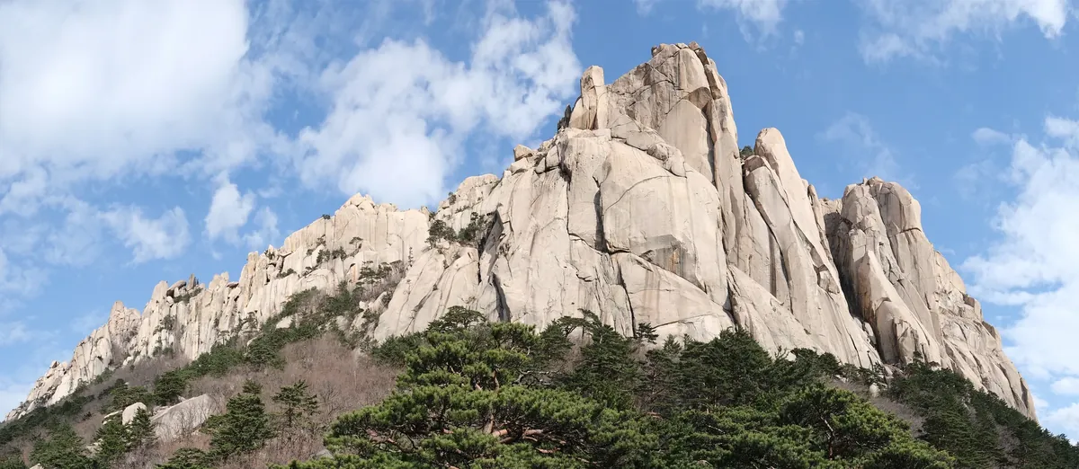
Seoraksan National Park (400.027 km²): Ulsanbawi, the Dinosaur Ridge and Cheonbuldong valley, Korea’s first UNESCO biosphere reserve.
-
15 Nov – 15 Dec 2026
Autumn fire-season trail closures
The Korea National Park Service closes 148 trail sections in the national parks for the autumn wildfire season: 115 fully and 33 in part. Other trails stay open as usual. Check the closure list for your park before you set off.
Plan your visit
Waterfalls on foot or Gwongeumseong by cable car?
Sogongwon gives you two distinct ways to see Outer Seorak: follow the waterfall valley or take the cable car toward Gwongeumseong. Choose the outing before arranging your bus journey from Sokcho.
-
A valley hike with a shorter turnaround
Biryong Falls and Towangseong viewpoint
Start at Seoraksan Sogongwon 설악산소공원
Follow the valley past Yukdam to Biryong Falls, where you can turn back. Continuing to the Towangseong Falls Observatory adds the steep final stair section. Our detailed guide separates the waterfall stop, viewpoint climb and return journey.
See the waterfall walk -
Mountain views with a paid cable-car ride
Gwongeumseong Cable Car
Start at Seorak Cable Car lower station at Sogongwon 설악케이블카
The cable car climbs from the Sogongwon area to Gwongeumseong. Buy a round-trip ticket at the lower station on the day: the operator sells on-site tickets only. Open its guide for fares, operating information and the boarding sequence.
Cable-car tickets and boarding
Both choices start from the Sogongwon side
The directions below bring you from Sokcho Express Bus Terminal to the Seorak-dong park entrance. From Sogongwon, follow the Biryong Falls signs for the walk or the cable-car signs for the lower station.
Place details
- Region
- Gangwon
- Type of place
- National park
Getting there
Start at Sokcho Express Bus Terminal
Entrance or stop 설악산소공원
- At the local bus stop by the terminal, board bus 7 or 7-1 displaying Seoraksan Sogongwon (설악산소공원). Some late 7-1 trips end at Daepo instead.
- Get off at the Sogongwon terminus in Seorak-dong and walk into the park entrance.
About Seoraksan National Park
Seoraksan National Park spreads over 400.027 km² of the Baekdudaegan and was designated on 24 March 1970. Three main ridges run from the highest peak, Daecheongbong, and divide it into Inner Seorak to the west, Outer Seorak to the east and South Seorak; Jeombongsan was added to the park in 2011.
Most of the mountain is Cretaceous granite, raised with the Taebaek range about 23 million years ago. The rock landscape around the Dinosaur Ridge (Gongnyong), Yongajangseong and Ulsanbawi is the finest of any Korean park, and the valleys of Sibiseonnyeotang, Gugokdam and Cheonbuldong are lined with falls and pools.
Plants of the north and south meet here, and animals of the Siberian region range down from the highlands. In 1982 UNESCO made Seoraksan Korea’s first biosphere reserve, and in December 2005 the IUCN listed it in Category II, national park.
Worth seeing
- Ulsanbawi 울산바위Granite rock wall, one of the park’s best-known landscapes.
- Gongnyong Ridge 공룡능선The Dinosaur Ridge, Seoraksan’s best-known rock ridge.
- Cheonbuldong Valley 천불동계곡Valley lined with falls and pools.
Written from the Korea National Park Service park introduction.