
National park · Gangwon / North Gyeongsang
Taebaeksan National Park
태백산국립공원
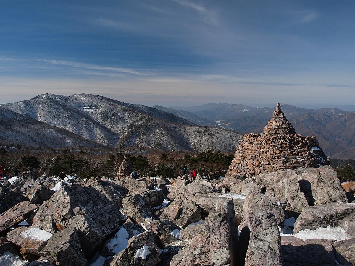
Taebaeksan National Park: Cheonjedan altar at 1,560 m, yew forests under snow and Hambaeksan at 1,572 m on the Baekdudaegan.
-
15 Nov – 15 Dec 2026
Autumn fire-season trail closures
The Korea National Park Service closes 148 trail sections in the national parks for the autumn wildfire season: 115 fully and 33 in part. Other trails stay open as usual. Check the closure list for your park before you set off.
Plan your visit
Choose your approach to Taebaeksan’s peaks
Cheonjedan’s summit altar, the yews around Janggunbong and Munsubong’s boulder landscape are different reasons to climb. Danggol and Yuilsa are distinct starting points.
-
The summit altar
Cheonjedan from Danggol
Start at Danggol Plaza 당골광장
The Danggol course climbs through Banjae and Manggyeongsa to Cheonjedan. Choose it to make the altar your main destination from the entrance served by the city bus below.
Taebaek’s official route map -
Yews and the high ridge
Janggunbong from Yuilsa
Start at Yuilsa entrance 유일사 입구
The Yuilsa approach reaches Janggunbong before Cheonjedan. The yew groves around Janggunbong are a defining part of Taebaeksan’s upper mountain scenery, especially in the winter landscape.
Compare the official approaches -
Boulder scenery
Munsubong from Danggol
Start at Danggol Plaza 당골광장
Choose the Munsubong course for the park’s boulder-covered summit landscape. It is a separate course from the direct Danggol approach to Cheonjedan, even though both begin at the plaza.
Find the Munsubong course
The city bus below reaches Danggol
The journey starts at Taebaek Intercity Bus Terminal and reaches the Danggol entrance and plaza. Select Yuilsa as a separate destination if you want the approach via Janggunbong.
Place details
- Region
- Gangwon · North Gyeongsang
- Type of place
- National park
Getting there
Start at Taebaek Intercity Bus Terminal
Entrance or stop 당골광장
- Take local bus 7 toward Danggol (당골) from Taebaek Intercity Bus Terminal.
- Get off at the Danggol entrance by the first parking area and continue on foot to Danggol Plaza (당골광장).
About Taebaeksan National Park
Taebaeksan, a sacred mountain at the centre of the Baekdudaegan, is the source of the Han and Nakdong rivers and Samcheok’s Osipcheon. It was a provincial park from 1989 and became a national park on 12 May 2016.
Its peaks are Yeongbong (1,560 m), with the Cheonjedan heaven altar, Janggunbong (1,567 m), Munsubong (1,517 m) and Busoebong (1,546 m); the highest point in the park is Hambaeksan (1,572 m). Geomnyongso’s potholes, Hambaeksan’s scree and Munsubong’s boulder field are its geology sites.
Alpine plants grow on the summit, which is known for its yew forests: azaleas in spring, cold streams in summer, colour in autumn and snow-covered yews in winter. The park records 2,637 species, among them the fox, the yellow-throated marten and the lenok.
Worth seeing
- Cheonjedan 천제단Heaven altar on Yeongbong, a National Folklore Cultural Heritage.
- Hambaeksan 함백산The park’s highest peak, 1,572 m.
- Geomnyongso 검룡소Pothole spring, one of the park’s geology sites.
Written from the Korea National Park Service park introduction.