
SEOUL · HIKES & CITY WALKS
Seoul hikes by public transport
A city-wall ridge, a forest circuit, a granite summit or a walk beside the water: choose the route that fits your day, then follow its station-to-trail directions.
Compare the walks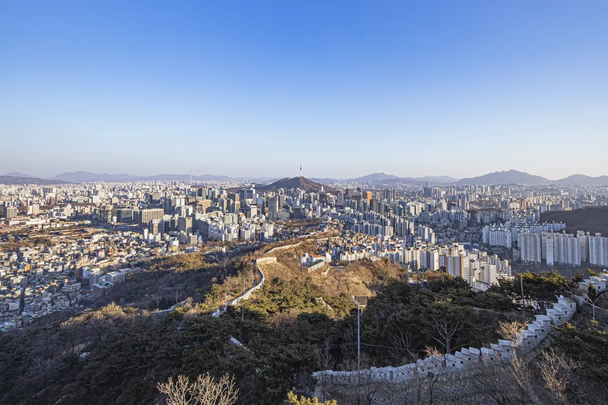
START WITH THE OUTING
Which walk fits your day?
The useful distinction is where the measured walk begins and where you finish. A subway station can be the start of your journey without being the start of the published trail.
| Place | Choose it for | The walk | Transport |
|---|---|---|---|
| Inwangsan city-wall trail | A city-wall ridge and granite viewpoints | 4 km · point to point | Seodaemun, Line 5; finish at Changuimun |
| Namsan Dulle-gil circuit | A forest circuit around the hill | 7.5 km · full circuit | Dongguk University, Line 3; return to the same station |
| Bukhansan Baegundae summit | A granite summit with a separate approach walk | 1.9 km · one way | Bukhansan Ui, Ui–Sinseol Line; return the same way |
| Cheonggyecheon to Gwangjang Market | Water, city streets and a market finish | Point to point · Cheonggye Plaza to the market | Gwanghwamun, Line 5; return from Jongno 5-ga, Line 1 |
01 / Seoul
Inwangsan city-wall trail
인왕산 성곽길
Choose this forCity views, fortress walls and a point-to-point mountain walk.
Walk the published section from the former Donuimun Gate site over Inwangsan to Changuimun. The views are close to the city, while the route itself includes fortress-wall steps, granite and exposed viewpoints.
The section ends at a different gate. Save the Changuimun bus connection before leaving Seodaemun.
Getting there
- Take Seoul Subway Line 5 to Seodaemun (서대문역). Use Exit 4 and walk about two minutes to the former site of Donuimun Gate (돈의문 터).
- Look for the old gate site, not a standing gate. Follow the Inwangsan section of the city wall toward Changuimun Gate (창의문).
Getting back
At Changuimun, walk to Jahamun Pass / Yun Dong-ju Literary Museum (자하문고개·윤동주문학관). Look up bus 1020 toward Gyeongbokgung Station for Subway Line 3; confirm the boarding side and current departures.
02 / Seoul
Namsan Dulle-gil circuit
남산둘레길
Choose this forA longer green circuit that returns to the same starting point.
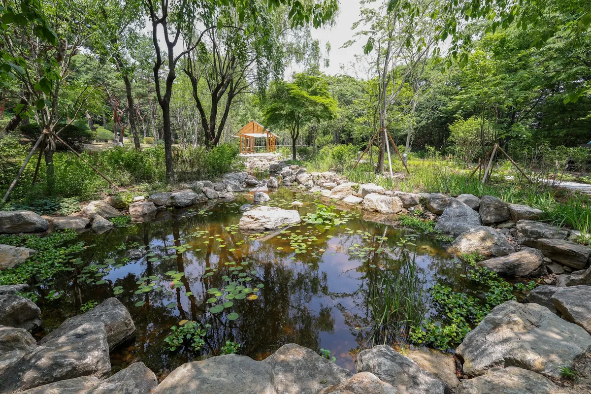
The full Dulle-gil circles Namsan through the broad North Ringway and narrower southern forest paths. Choose it for a complete circuit with changing slopes and woodland, and follow the Dulle-gil map at junctions.
The 7.5 km is the full Dulle-gil circuit. A walk up to N Seoul Tower follows a different route.
Getting there
- Take Seoul Subway Line 3 to Dongguk University (동대입구역). Leave by Exit 6 and walk toward the National Theater of Korea (국립극장); the theater estimates 10–15 minutes on foot.
- Near the theater, join the Namsan Dulle-gil at the North Ringway entrance (북측순환로 입구). Use the park map to follow the circuit rather than the route up to N Seoul Tower.
Getting back
The circuit brings you back to the North Ringway entrance. From the National Theater, retrace the walk to Dongguk University Station for Line 3.
Official route and transport sources
03 / Seoul
Bukhansan Baegundae summit
북한산 백운대
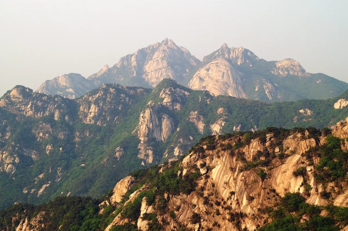
Choose this forA mountain day with rocky ground, a steep final ascent and a summit objective.
This choice needs more planning than the short published trail length suggests. From Bukhansan Ui Station, reach the Baegun Visitor Center near Doseonsa first, then climb toward Baegundae on rock and steps with handrails near the top.
The published 1.9 km and 1 hr 30 min describe the outward summit trail from Baegun Visitor Center. Add the station approach, descent and walk back to the subway.
Getting there
- Take the Ui–Sinseol Line to Bukhansan Ui (북한산우이역). Leave by Exit 2 and walk about five minutes to the Seoul Hiking Tourism Center.
- From the hiking center, follow the mapped Ui Gugok approach past Chanunbong (찬운봉) to the Baegun Visitor Center (백운탐방지원센터). This approach is on foot; the five-minute walk is only the first part.
- Start the summit trail at the Baegun Visitor Center, near Doseonsa Temple. The published 1.9 km starts here, not at the subway.
Getting back
Retrace the summit trail to the visitor center and the approach to Bukhansan Ui Station. Allow time for both before checking your train home.
Official route and transport sources
04 / Seoul
Cheonggyecheon to Gwangjang Market
청계천·광장시장
Choose this forA streamside city walk that finishes beside market food stalls.
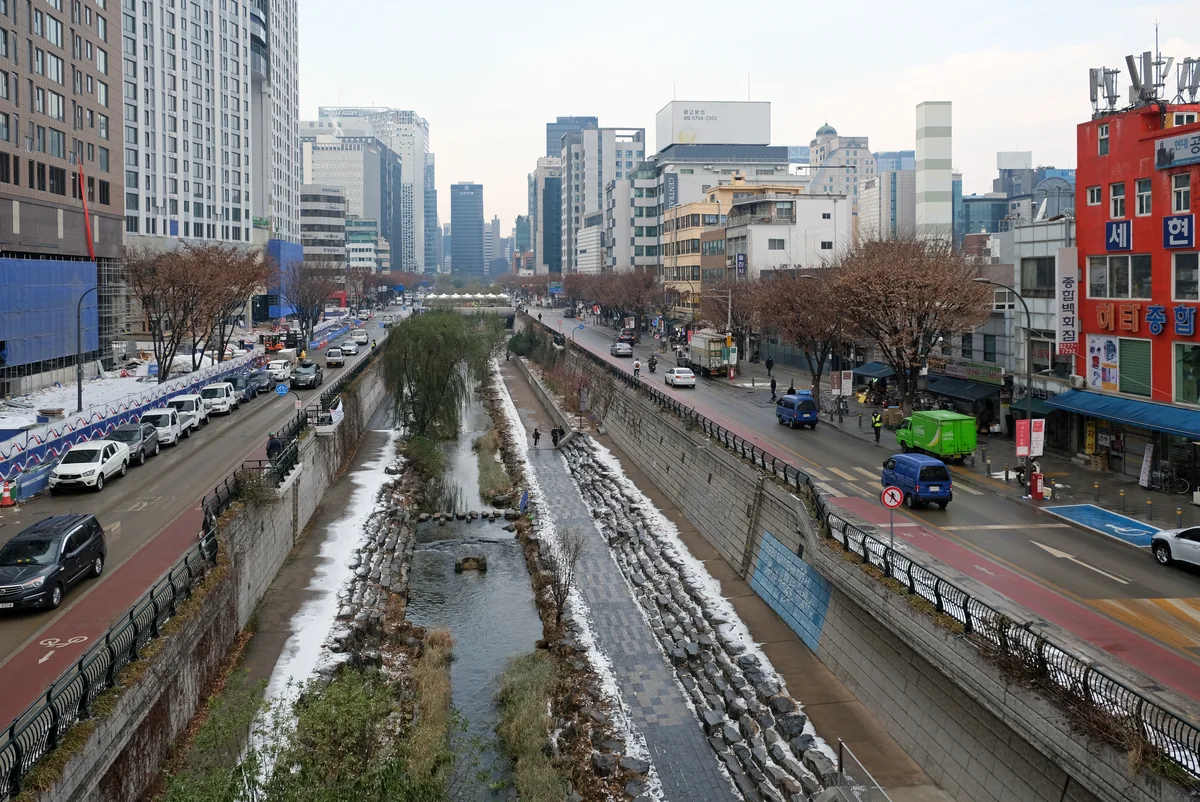
Start at Cheonggye Plaza and follow the south bank east. At Saebyeokdari Bridge, climb to street level, cross to the north bank and continue to Gwangjang Market. Choose this when you want water and a food stop in central Seoul.
This is a city walk with a staircase exit at Saebyeokdari. The full guide shows the bridge names and the market connection.
Getting there
- Take Line 5 to Gwanghwamun Station (광화문역), Exit 5.
- Walk to Cheonggye Plaza (청계광장). The spiral Spring sculpture marks the starting area.
Getting back
After the market, use Exit 8 of Jongno 5-ga Station (종로5가역) for Line 1. Start your return route from the market rather than Cheonggye Plaza.
MAKE THE JOURNEY WORK
Before choosing your departure
Choose the finish first
Inwangsan and Cheonggyecheon finish away from their starting stations. Namsan returns to its trail entrance, while Baegundae needs a descent and a separate approach walk back to Bukhansan Ui.
Read distance from its named start
The 4 km Inwangsan section, 7.5 km Namsan circuit and 1.9 km outward Baegundae trail describe different route shapes. Compare the whole outing, including the station approach and return.
Pick the surface you want
Inwangsan and Baegundae include rock and steps. Namsan mixes a broad ringway with narrower forest paths. Cheonggyecheon keeps the outing in the city, with stairs between the lower path and street level.