
National park · South Jeolla / North Jeolla / South Gyeongsang
Jirisan National Park
지리산국립공원
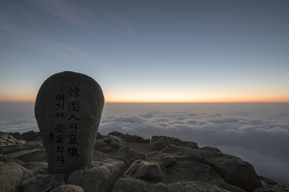
Jirisan National Park (483.022 km²): Korea’s first national park, with Cheonwangbong at 1,915 m and a 25.5 km main ridge.
-
15 Nov – 15 Dec 2026
Autumn fire-season trail closures
The Korea National Park Service closes 148 trail sections in the national parks for the autumn wildfire season: 115 fully and 33 in part. Other trails stay open as usual. Check the closure list for your park before you set off.
Plan your visit
A temple valley or the high mountain landscape?
Jirisan spreads across three provinces. Hwaeomsa and Seongsamjae offer two distinct ways into its southwestern side, with different journeys and walking objectives.
-
Valley scenery and a temple approach
Hwaeomsa and Hwaeom Valley
Start at Hwaeomsa Iljumun gate 화엄사 일주문
Use Hwaeomsa as your destination for the temple approach and the valley below Jirisan’s high ridges. The bus journey from Gwangju reaches this Gurye-side entrance; decide separately how far to continue into the mountain.
Getting to Hwaeomsa -
High mountain vegetation and views
Nogodan from Seongsamjae
Start at Seongsamjae rest area 성삼재휴게소
The official Nogodan approach starts at Seongsamjae and passes Munenggi on the way to Nogodan Pass. The onward section from the pass to Nogodan’s summit has its own KNPS reservation service.
Nogodan summit reservations
The transport route below reaches Hwaeomsa
Take the Hwaeomsa service from Gwangju U-Square for the temple approach. A bus terminating in Gurye town stops short of the entrance. Seongsamjae is a separate destination for the Nogodan option.
Place details
- Region
- South Jeolla · North Jeolla · South Gyeongsang
- Type of place
- National park
Getting there
Start at Gwangju U-Square Bus Terminal
Entrance or stop 화엄사 일주문
- At U-Square, look for an intercity departure to Hwaeomsa (화엄사). Buses ending in Gurye town stop short of the temple approach.
- Get off at Hwaeomsa. Continue on foot along the temple approach toward the Iljumun gate (화엄사 일주문) in the Hwaeom Valley section of the park.
About Jirisan National Park
Jirisan became Korea’s first national park on 29 December 1967. Its 483.022 km² across South Gyeongsang, South Jeolla and North Jeolla make it the largest mountain park of the country’s 24 national parks.
More than twenty peaks over 1,500 m spread like a folding screen around three main summits, Cheonwangbong (1,915 m), Banyabong (1,732 m) and Nogodan (1,507 m). The main ridge from Cheonwangbong to Nogodan runs 25.5 km, and great valleys such as Chilseon, Hansin, Daewonsa, Piagol and Baemsagol lie in its folds.
The name reads as the mountain of the wise and unusual. With Geumgangsan and Hallasan it was one of the three sacred mountains, and names like Banyabong and Nogodan recall that faith. Rivers run from it north to the Nakdong and south as the Seomjin.
Worth seeing
- Cheonwangbong 천왕봉The 1,915 m summit, highest point of the park.
- Nogodan 노고단Main peak at 1,507 m, at one end of the main ridge.
- Piagol and Baemsagol 피아골·뱀사골Two of the great valleys, both geology sites.
Written from the Korea National Park Service park introduction.