
National park · North Jeolla / South Gyeongsang
Deogyusan National Park
덕유산국립공원
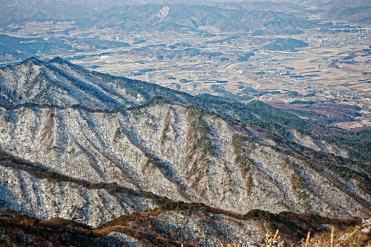
Deogyusan National Park: Hyangjeokbong at 1,614 m, a 30 km ridge of the Baekdudaegan and the 33 scenes of Gucheondong valley.
-
15 Nov – 15 Dec 2026
Autumn fire-season trail closures
The Korea National Park Service closes 148 trail sections in the national parks for the autumn wildfire season: 115 fully and 33 in part. Other trails stay open as usual. Check the closure list for your park before you set off.
Plan your visit
Choose the valley or a summit
Gucheondong’s streams and Deogyusan’s long mountain ridge make very different outings. The Muju bus approach serves the northern valley; Namdeogyusan has its own southern entrance.
-
Streams and woodland
Gucheondong Valley
Start at Gucheondong visitor support centre 구천동탐방지원센터
Follow the valley towards Baengnyeonsa for pools, rock terraces and waterfalls. Choose your turning point along the valley when the stream scenery is the purpose of the day.
Official Gucheondong route -
The northern summit
Hyangjeokbong via Baengnyeonsa
Start at Gucheondong visitor support centre 구천동탐방지원센터
The same approach continues beyond Baengnyeonsa into the climb to Hyangjeokbong. Select the complete summit course when you want ridge views, and use its full route description to plan the return.
Official Hyangjeokbong course -
The southern mountain ridge
Namdeogyusan from Yeonggak
Start at Yeonggak visitor support centre 영각탐방지원센터
This southern approach climbs towards Namdeogyusan, where the Baekdudaegan ridge extends into the distance. It uses a different trailhead from Gucheondong and includes steep mountain steps.
Official Namdeogyusan course
The Muju bus reaches Gucheondong
The journey below runs from Muju Bus Terminal to Gucheondong Bus Terminal, followed by the approach to the visitor support centre. Use it for the valley and the Baengnyeonsa–Hyangjeokbong course; arrange a separate arrival for Yeonggak.
Place details
- Region
- North Jeolla · South Gyeongsang
- Type of place
- National park
Getting there
Start at Muju Bus Terminal
Entrance or stop 구천동탐방지원센터
- At Muju Bus Terminal take a bus bound for Gucheondong (구천동). Get off at Gucheondong Bus Terminal.
- Continue on foot to Gucheondong Visitor Support Center (구천동탐방지원센터), where the park's valley trail begins.
Coming back Muju County lists buses back to Muju under Gucheondong Terminal (구천동터미널); check that table before starting the valley walk.
Transport sources checked .About Deogyusan National Park
Deogyusan became Korea’s tenth national park on 1 February 1975, the same day as Odaesan. It rises across two provinces and four counties, Muju and Jangsu in North Jeolla and Geochang and Hamyang in South Gyeongsang, and forms part of the Baekdudaegan.
From the summit, Hyangjeokbong (1,614 m), a heavy ridge of around 1,300 m runs some 30 km to the south-west. The name is said to mean a generous mother mountain of great virtue.
Gucheondong valley, with 13 terraces, about ten pools and 20 waterfalls, was divided by earlier writers into 33 scenes. The gneiss bedrock gives the high ground from Hyangjeokbong to Namdeogyusan its massive, rounded shape.
Worth seeing
- Gucheondong Valley 구천동 계곡Rocky pools, terraces and falls named in 33 scenes.
- Hyangjeokbong 향적봉The 1,614 m main summit.
- Namdeogyusan 남덕유산The southern end of the high ridge.
Written from the Korea National Park Service park introduction.