
National park · South Jeolla
Wolchulsan National Park
월출산국립공원
Choose Cheonhwang for Cloud Bridge, Gyeongpodae for the climb to Cheonhwangbong, or Dogapsa for woodland and the ridge towards Gujeongbong.
-
15 Nov – 15 Dec 2026
Autumn fire-season trail closures
The Korea National Park Service closes 148 trail sections in the national parks for the autumn wildfire season: 115 fully and 33 in part. Other trails stay open as usual. Check the closure list for your park before you set off.
Plan your visit
Choose the bridge, the summit or the Dogapsa ridge
Wolchulsan's granite peaks rise above separate valleys. Cheonhwang, Gyeongpodae and Dogapsa are different trailheads; choose the walk before planning the journey to the mountain.
-
A suspension bridge among granite peaks
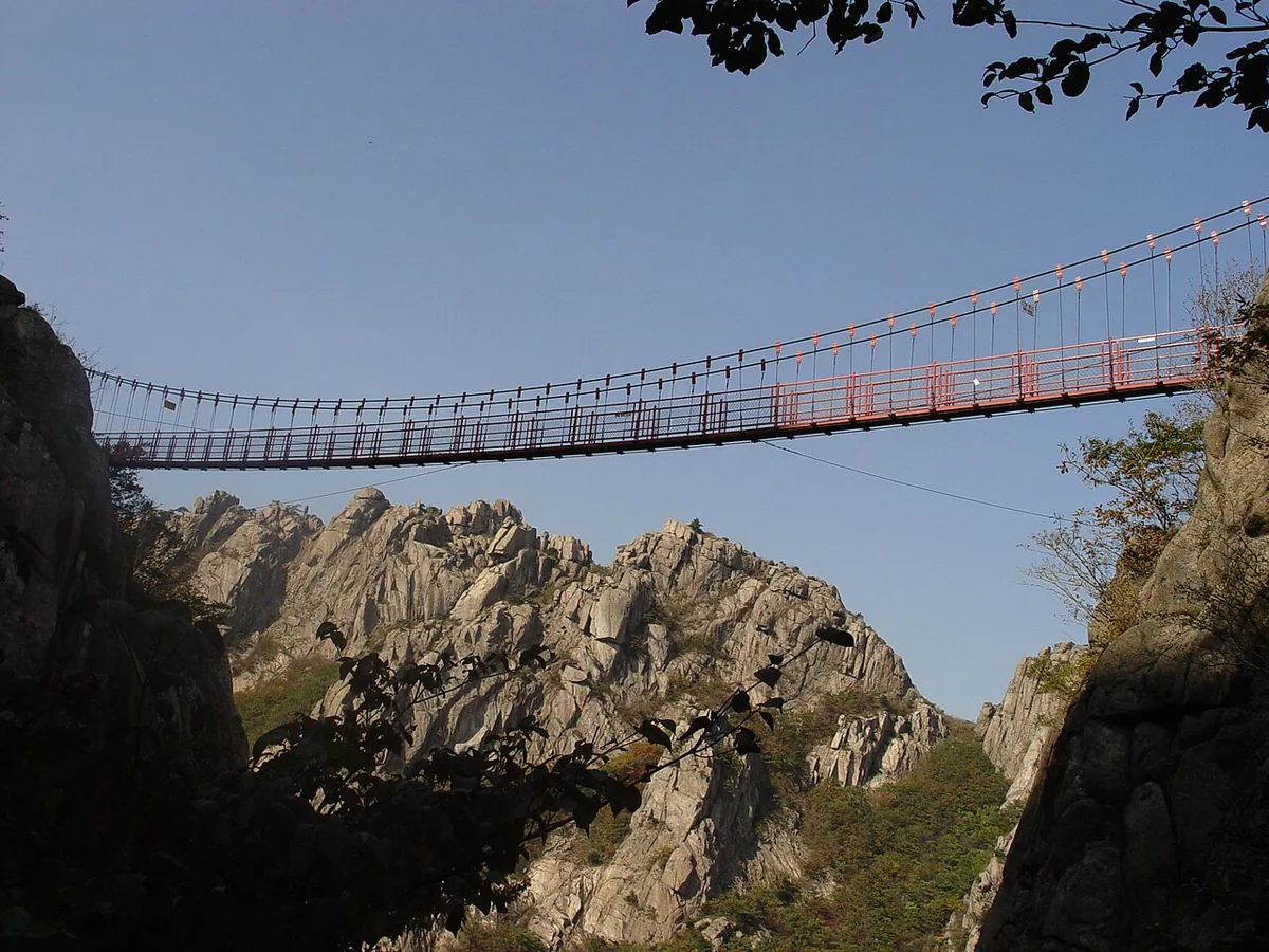
Cloud Bridge from Cheonhwang
Start at Cheonhwang visitor support centre 천황탐방지원센터
Climb past Cheonhwangsa to Cloud Bridge. The official bridge circuit descends towards the Baram Waterfall junction and Cheonhwang Valley, with steep paths and metal steps. Cheonhwangbong is part of the longer summit circuit, so choose that full course if you want to continue to the peak.
Official Cloud Bridge circuit -
The summit from a wooded valley
Cheonhwangbong from Gyeongpodae
Start at Gyeongpodae visitor support centre 경포대탐방지원센터
Follow Geumneung Gyeongpodae Valley to the ridge junction and Cheonhwangbong. The official course continues down past Baram Waterfall to the Cheonhwang entrance. If you follow the full crossing, plan your journey home from Cheonhwang rather than the valley where you started.
Official Gyeongpodae–Cheonhwang course -
Temple woodland, silver grass and the ridge
Dogap Valley and Gujeongbong
Start at Dogapsa temple entrance 도갑사 입구
Begin with Dogapsa and the wooded Dogap Valley, then climb towards the silver-grass area and Gujeongbong for granite ridge scenery. The full KNPS course descends from Baramjae to Gyeongpodae and finishes at a different entrance. This is the starting point reached by the Yeongam bus below.
Official Dogapsa–Gyeongpodae course
The bus below arrives at Dogapsa
From Yeongam Bus Terminal, choose the local bus specifically bound for Dogapsa. It serves the temple and Dogap Valley approach. Plan a separate arrival for Cheonhwang or Gyeongpodae, and use your finishing entrance when arranging the return from a crossing.
Place details
- Region
- South Jeolla
- Type of place
- National park
Getting there
Start at Yeongam Bus Terminal
Entrance or stop 도갑사
- At Yeongam Terminal, look for the infrequent local bus specifically bound for Dogapsa (도갑사). Check the departure before travelling.
- Ride to the Dogapsa stop for the temple-side entrance to Wolchulsan.
About Wolchulsan National Park
Wolchulsan, the moon-rising mountain, is the southernmost mountain national park on the peninsula. It was a provincial park from 1973 and became a national park on 11 June 1988. Its 56.220 km² of bare rock and steep, dry valleys still hold about 700 plant and 800 animal species where warm-temperate and temperate forests meet.
Late Cretaceous granite has weathered into tors, rock basins, honeycomb hollows and caves. Gujeongbong takes its name from nine well-like basins on top of Janggun Rock.
Dogapsa and Muwisa are temples more than a thousand years old, and the rock-carved seated Buddha is the highest-placed national treasure in Korea. The main ridge from the Cheonhwangsa site or Baram valley over Cheonhwangbong and Gujeongbong to Dogapsa takes about six hours on steep ground, passing the country’s highest cloud bridge and the silver grass of Miwangjae.
Worth seeing
- Cloud Bridge 구름다리Suspension bridge between rock peaks, the highest in Korea.
- Gujeongbong 구정봉Peak named for its nine rock-basin pools.
- Dogapsa 도갑사Temple of more than a thousand years at the end of the main ridge.
Written from the Korea National Park Service park introduction.